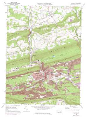
Shamokin Topo Map Pennsylvania
To zoom in, hover over the map of Shamokin
USGS Topo Quad 40076g5 - 1:24,000 scale
| Topo Map Name: | Shamokin |
| USGS Topo Quad ID: | 40076g5 |
| Print Size: | ca. 21 1/4" wide x 27" high |
| Southeast Coordinates: | 40.75° N latitude / 76.5° W longitude |
| Map Center Coordinates: | 40.8125° N latitude / 76.5625° W longitude |
| U.S. State: | PA |
| Filename: | o40076g5.jpg |
| Download Map JPG Image: | Shamokin topo map 1:24,000 scale |
| Map Type: | Topographic |
| Topo Series: | 7.5´ |
| Map Scale: | 1:24,000 |
| Source of Map Images: | United States Geological Survey (USGS) |
| Alternate Map Versions: |
Shamokin PA 1969, updated 1972 Download PDF Buy paper map Shamokin PA 1969, updated 1978 Download PDF Buy paper map Shamokin PA 2010 Download PDF Buy paper map Shamokin PA 2013 Download PDF Buy paper map Shamokin PA 2016 Download PDF Buy paper map |
1:24,000 Topo Quads surrounding Shamokin
> Back to 40076e1 at 1:100,000 scale
> Back to 40076a1 at 1:250,000 scale
> Back to U.S. Topo Maps home
Shamokin topo map: Gazetteer
Shamokin: Airports
Helfricks Heliport elevation 342m 1122′Northumberland County Airport elevation 262m 859′
Shamokin: Dams
Trout Run Dam Number Four elevation 267m 875′Shamokin: Parks
Kemp Stadium elevation 263m 862′Shamokin: Populated Places
Bear Gap elevation 254m 833′Bear Valley elevation 254m 833′
Big Mountain elevation 292m 958′
Boydtown elevation 274m 898′
Burnside elevation 299m 980′
Cabel elevation 195m 639′
Coal Run elevation 278m 912′
Edgewood elevation 242m 793′
Elysburg elevation 179m 587′
Fairview elevation 290m 951′
Ferndale elevation 308m 1010′
Gowen City elevation 294m 964′
Greenback elevation 276m 905′
Kulps elevation 296m 971′
Marshallton elevation 269m 882′
Meadowview elevation 174m 570′
Overlook elevation 236m 774′
Paxinos elevation 171m 561′
Point Breeze elevation 304m 997′
Ranshaw elevation 261m 856′
Reed elevation 168m 551′
Shamokin elevation 220m 721′
Shamrock elevation 172m 564′
Snufftown elevation 220m 721′
Sunnyside elevation 202m 662′
Uniontown elevation 199m 652′
Shamokin: Post Offices
Crowl Post Office (historical) elevation 168m 551′Ranshaw Post Office (historical) elevation 261m 856′
Shamokin: Reservoirs
Number Four Reservoir elevation 268m 879′Number One Reservoir elevation 258m 846′
Shamokin: Ridges
Gilgers Ridge elevation 326m 1069′Shamokin: Streams
Bennys Run elevation 177m 580′Buck Creek (historical) elevation 236m 774′
Carbon Run elevation 219m 718′
Coal Run elevation 222m 728′
Furnace Run elevation 226m 741′
Lick Creek elevation 168m 551′
Millers Run elevation 171m 561′
Quaker Run elevation 253m 830′
Trout Run elevation 200m 656′
Shamokin: Summits
Mahanoy Mountain elevation 433m 1420′Shamokin: Valleys
Bear Valley elevation 227m 744′Brush Valley elevation 220m 721′
Shamokin digital topo map on disk
Buy this Shamokin topo map showing relief, roads, GPS coordinates and other geographical features, as a high-resolution digital map file on DVD:
Atlantic Coast (NY, NJ, PA, DE, MD, VA, NC)
Buy digital topo maps: Atlantic Coast (NY, NJ, PA, DE, MD, VA, NC)


