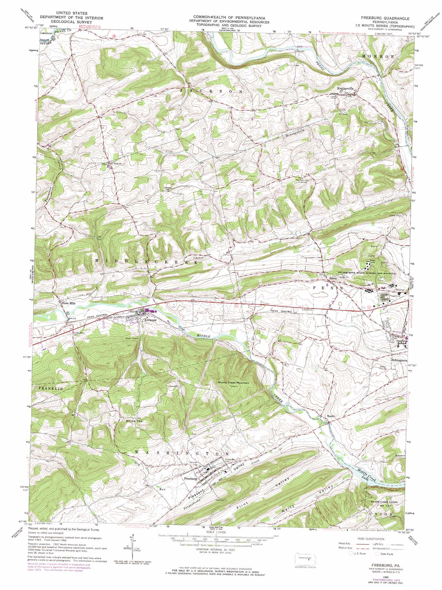
Freeburg Topo Map Pennsylvania
To zoom in, hover over the map of Freeburg
USGS Topo Quad 40076g8 - 1:24,000 scale
| Topo Map Name: | Freeburg |
| USGS Topo Quad ID: | 40076g8 |
| Print Size: | ca. 21 1/4" wide x 27" high |
| Southeast Coordinates: | 40.75° N latitude / 76.875° W longitude |
| Map Center Coordinates: | 40.8125° N latitude / 76.9375° W longitude |
| U.S. State: | PA |
| Filename: | o40076g8.jpg |
| Download Map JPG Image: | Freeburg topo map 1:24,000 scale |
| Map Type: | Topographic |
| Topo Series: | 7.5´ |
| Map Scale: | 1:24,000 |
| Source of Map Images: | United States Geological Survey (USGS) |
| Alternate Map Versions: |
Freeburg PA 1965, updated 1967 Download PDF Buy paper map Freeburg PA 1965, updated 1973 Download PDF Buy paper map Freeburg PA 2010 Download PDF Buy paper map Freeburg PA 2013 Download PDF Buy paper map Freeburg PA 2016 Download PDF Buy paper map |
1:24,000 Topo Quads surrounding Freeburg
Carroll |
Williamsport Se |
Allenwood |
Milton |
Washingtonville |
Hartleton |
Mifflinburg |
Lewisburg |
Northumberland |
Riverside |
Beavertown |
Middleburg |
Freeburg |
Sunbury |
Trevorton |
Beaver Springs |
Richfield |
Dalmatia |
Pillow |
Klingerstown |
Millerstown |
Reward |
Millersburg |
Elizabethville |
Lykens |
> Back to 40076e1 at 1:100,000 scale
> Back to 40076a1 at 1:250,000 scale
> Back to U.S. Topo Maps home
Freeburg topo map: Gazetteer
Freeburg: Parks
State Game Lands Number 212 elevation 225m 738′Freeburg: Populated Places
Freeburg elevation 162m 531′Globe Mills elevation 150m 492′
Kantz elevation 138m 452′
Kratzerville elevation 205m 672′
Kreamer elevation 147m 482′
Meiser Station elevation 147m 482′
Pawling Station elevation 144m 472′
Salem elevation 183m 600′
Freeburg: Reservoirs
Middle Creek Lake elevation 131m 429′Freeburg: Streams
Dry Run elevation 154m 505′Monongahela Creek elevation 134m 439′
Susquehecka Creek elevation 134m 439′
Freeburg: Summits
Middle Creek Mountain elevation 339m 1112′White Top elevation 322m 1056′
Freeburg: Valleys
Flint Valley elevation 138m 452′Neitz Valley elevation 133m 436′
Pleasant Valley elevation 137m 449′
Freeburg digital topo map on disk
Buy this Freeburg topo map showing relief, roads, GPS coordinates and other geographical features, as a high-resolution digital map file on DVD:
Atlantic Coast (NY, NJ, PA, DE, MD, VA, NC)
Buy digital topo maps: Atlantic Coast (NY, NJ, PA, DE, MD, VA, NC)
 map DVD")