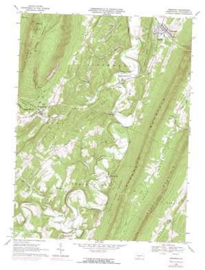
Orbisonia Topo Map Pennsylvania
To zoom in, hover over the map of Orbisonia
USGS Topo Quad 40077b8 - 1:24,000 scale
| Topo Map Name: | Orbisonia |
| USGS Topo Quad ID: | 40077b8 |
| Print Size: | ca. 21 1/4" wide x 27" high |
| Southeast Coordinates: | 40.125° N latitude / 77.875° W longitude |
| Map Center Coordinates: | 40.1875° N latitude / 77.9375° W longitude |
| U.S. State: | PA |
| Filename: | o40077b8.jpg |
| Download Map JPG Image: | Orbisonia topo map 1:24,000 scale |
| Map Type: | Topographic |
| Topo Series: | 7.5´ |
| Map Scale: | 1:24,000 |
| Source of Map Images: | United States Geological Survey (USGS) |
| Alternate Map Versions: |
Orbisonia PA 1966, updated 1969 Download PDF Buy paper map Orbisonia PA 1966, updated 1973 Download PDF Buy paper map Orbisonia PA 1966, updated 1990 Download PDF Buy paper map Orbisonia PA 2010 Download PDF Buy paper map Orbisonia PA 2013 Download PDF Buy paper map Orbisonia PA 2016 Download PDF Buy paper map |
1:24,000 Topo Quads surrounding Orbisonia
> Back to 40077a1 at 1:100,000 scale
> Back to 40076a1 at 1:250,000 scale
> Back to U.S. Topo Maps home
Orbisonia topo map: Gazetteer
Orbisonia: Airports
Beers Farm Airport elevation 191m 626′IBM Distribution Center Heliport elevation 256m 839′
Memmi Airport elevation 341m 1118′
Orbisonia: Gaps
Hoopers Gap elevation 437m 1433′Orbisonia: Parks
State Game Lands Number 81 elevation 342m 1122′State Game Lands Number 99 elevation 622m 2040′
Orbisonia: Populated Places
Maddensville elevation 222m 728′Meadow Gap elevation 219m 718′
Mentzer elevation 348m 1141′
Orbisonia elevation 194m 636′
Pogue elevation 197m 646′
Rockhill elevation 189m 620′
Selea elevation 268m 879′
Three Springs elevation 225m 738′
Orbisonia: Ridges
Johnson Ridge elevation 276m 905′Saddle Back Ridge elevation 280m 918′
Shopes Ridge elevation 289m 948′
Orbisonia: Streams
Craig Run elevation 247m 810′Elliot Run elevation 217m 711′
Laurel Run elevation 186m 610′
Lick Run elevation 203m 666′
Little Aughwick Creek elevation 212m 695′
North Spring Branch elevation 216m 708′
Sideling Hill Creek elevation 212m 695′
Sinking Run elevation 213m 698′
Spring Creek elevation 216m 708′
Three Springs Creek elevation 189m 620′
Orbisonia: Valleys
Locke Valley elevation 254m 833′Orbisonia digital topo map on disk
Buy this Orbisonia topo map showing relief, roads, GPS coordinates and other geographical features, as a high-resolution digital map file on DVD:
Atlantic Coast (NY, NJ, PA, DE, MD, VA, NC)
Buy digital topo maps: Atlantic Coast (NY, NJ, PA, DE, MD, VA, NC)


