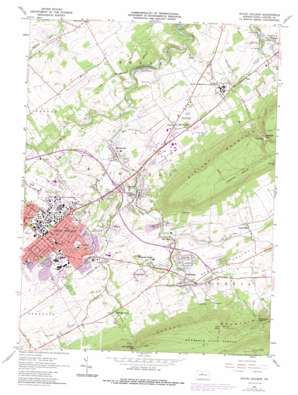
State College Topo Map Pennsylvania
To zoom in, hover over the map of State College
USGS Topo Quad 40077g7 - 1:24,000 scale
| Topo Map Name: | State College |
| USGS Topo Quad ID: | 40077g7 |
| Print Size: | ca. 21 1/4" wide x 27" high |
| Southeast Coordinates: | 40.75° N latitude / 77.75° W longitude |
| Map Center Coordinates: | 40.8125° N latitude / 77.8125° W longitude |
| U.S. State: | PA |
| Filename: | o40077g7.jpg |
| Download Map JPG Image: | State College topo map 1:24,000 scale |
| Map Type: | Topographic |
| Topo Series: | 7.5´ |
| Map Scale: | 1:24,000 |
| Source of Map Images: | United States Geological Survey (USGS) |
| Alternate Map Versions: |
State College PA 1962, updated 1964 Download PDF Buy paper map State College PA 1962, updated 1968 Download PDF Buy paper map State College PA 1962, updated 1972 Download PDF Buy paper map State College PA 1962, updated 1987 Download PDF Buy paper map State College PA 1962, updated 1987 Download PDF Buy paper map State College PA 1977, updated 1979 Download PDF Buy paper map State College PA 2010 Download PDF Buy paper map State College PA 2013 Download PDF Buy paper map State College PA 2016 Download PDF Buy paper map |
1:24,000 Topo Quads surrounding State College
> Back to 40077e1 at 1:100,000 scale
> Back to 40076a1 at 1:250,000 scale
> Back to U.S. Topo Maps home
State College topo map: Gazetteer
State College: Airports
University Park Airport elevation 367m 1204′State College: Dams
Rockview Reservoir Dam elevation 497m 1630′State College: Gaps
Galbraith Gap elevation 441m 1446′McBride Gap elevation 447m 1466′
Shingletown Gap elevation 460m 1509′
State College: Parks
Beaver Stadium elevation 351m 1151′Holmes-Foster Park elevation 352m 1154′
Sunset View Park elevation 361m 1184′
Twenty-Eighth Division Memorial Shrine elevation 322m 1056′
State College: Populated Places
Boalsburg elevation 337m 1105′Dale Summit elevation 333m 1092′
Dalevue elevation 330m 1082′
Harris Acres elevation 362m 1187′
Houserville elevation 300m 984′
Hunter Park elevation 315m 1033′
Lemont elevation 309m 1013′
Linden Hall elevation 343m 1125′
Oak Hall elevation 318m 1043′
Panorama Village elevation 356m 1167′
Peru elevation 304m 997′
Shingletown elevation 340m 1115′
State College elevation 355m 1164′
University Park elevation 348m 1141′
State College: Reservoirs
Rockview Reservoir elevation 497m 1630′State College: Springs
Benner Spring elevation 285m 935′Blue Spring elevation 280m 918′
Shutgart Spring elevation 276m 905′
Thompson Spring elevation 307m 1007′
State College: Streams
Cedar Run elevation 318m 1043′Galbraith Gap Run elevation 354m 1161′
Mackeys Run elevation 342m 1122′
Roaring Run elevation 327m 1072′
Slab Cabin Run elevation 291m 954′
Tannery Run elevation 335m 1099′
Thompson Run elevation 304m 997′
State College: Summits
Bald Knob elevation 700m 2296′State College: Swamps
Thompsons Meadow elevation 308m 1010′State College: Valleys
Big Hollow elevation 280m 918′Penns Valley elevation 338m 1108′
State College digital topo map on disk
Buy this State College topo map showing relief, roads, GPS coordinates and other geographical features, as a high-resolution digital map file on DVD:
Atlantic Coast (NY, NJ, PA, DE, MD, VA, NC)
Buy digital topo maps: Atlantic Coast (NY, NJ, PA, DE, MD, VA, NC)


