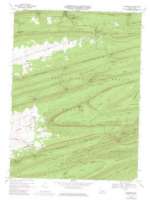
Woodward Topo Map Pennsylvania
To zoom in, hover over the map of Woodward
USGS Topo Quad 40077h3 - 1:24,000 scale
| Topo Map Name: | Woodward |
| USGS Topo Quad ID: | 40077h3 |
| Print Size: | ca. 21 1/4" wide x 27" high |
| Southeast Coordinates: | 40.875° N latitude / 77.25° W longitude |
| Map Center Coordinates: | 40.9375° N latitude / 77.3125° W longitude |
| U.S. State: | PA |
| Filename: | o40077h3.jpg |
| Download Map JPG Image: | Woodward topo map 1:24,000 scale |
| Map Type: | Topographic |
| Topo Series: | 7.5´ |
| Map Scale: | 1:24,000 |
| Source of Map Images: | United States Geological Survey (USGS) |
| Alternate Map Versions: |
Woodward PA 1968, updated 1971 Download PDF Buy paper map Woodward PA 1968, updated 1975 Download PDF Buy paper map Woodward PA 1968, updated 1980 Download PDF Buy paper map Woodward PA 2010 Download PDF Buy paper map Woodward PA 2013 Download PDF Buy paper map Woodward PA 2016 Download PDF Buy paper map |
1:24,000 Topo Quads surrounding Woodward
> Back to 40077e1 at 1:100,000 scale
> Back to 40076a1 at 1:250,000 scale
> Back to U.S. Topo Maps home
Woodward topo map: Gazetteer
Woodward: Areas
Hairy Johns Picnic Area elevation 530m 1738′Woodward: Capes
North Prong Thick Mountain elevation 598m 1961′South Prong Thick Mountain elevation 593m 1945′
Woodward: Gaps
Barner Gap elevation 461m 1512′Bear Gap elevation 483m 1584′
Bull Run Gap elevation 466m 1528′
Greenburr Gap elevation 475m 1558′
Haines Gap elevation 397m 1302′
Hosterman Gap elevation 465m 1525′
Hough Gap elevation 495m 1624′
Stover Gap elevation 497m 1630′
Whetstone Gap elevation 452m 1482′
Winkelblech Gap elevation 514m 1686′
Wohlford Gap elevation 467m 1532′
Wolfs Store Gap elevation 456m 1496′
Woodward Gap elevation 425m 1394′
Woodward: Parks
Joyce Kilmer Monument elevation 660m 2165′Voneida State Forest Park (historical) elevation 463m 1519′
Woodward: Populated Places
Livonia elevation 457m 1499′Woodward elevation 348m 1141′
Woodward: Ridges
Nittany Mountain elevation 613m 2011′Woodward Mountain elevation 541m 1774′
Woodward: Springs
Cinder Pile Spring elevation 533m 1748′Horse Path Spring elevation 609m 1998′
Woodward: Streams
Barner Run elevation 376m 1233′Bear Run elevation 326m 1069′
Railroad Creek elevation 425m 1394′
Sheesley Run elevation 355m 1164′
Stony Run elevation 400m 1312′
Voneida Run elevation 344m 1128′
Wohlford Run elevation 401m 1315′
Woodward: Summits
Bear Mountain elevation 569m 1866′Hall Mountain elevation 627m 2057′
Hough Mountain elevation 640m 2099′
Paddy Mountain elevation 660m 2165′
Sand Mountain elevation 555m 1820′
Sharpback Mountain elevation 585m 1919′
Shriner Mountain elevation 665m 2181′
Third Green Knob elevation 513m 1683′
Winkelblech Mountain elevation 668m 2191′
Woodward Mountain elevation 541m 1774′
Woodward: Trails
Bear Run Trail elevation 587m 1925′Black Gap Trail elevation 534m 1751′
Brush Hollow Trail elevation 649m 2129′
Cherry Run Trail elevation 502m 1646′
Fallen Timber Trail elevation 649m 2129′
Haines Path elevation 646m 2119′
Hairy John Trail elevation 573m 1879′
Hall Trail elevation 570m 1870′
Hough Mountain Trail elevation 575m 1886′
Joyce Kilmer Trail elevation 406m 1332′
Kesseler Trail elevation 552m 1811′
Martin Hollow Trail elevation 511m 1676′
Old Tar Trail elevation 660m 2165′
Panther Hollow Trail elevation 527m 1729′
Rock Knob Trail elevation 637m 2089′
Sand Hollow Fire Trail elevation 514m 1686′
Sand Hollow Trail elevation 519m 1702′
Schade Trail elevation 569m 1866′
Sharpback Trail elevation 572m 1876′
Sheesley Hollow Trail elevation 624m 2047′
Woodward: Valleys
Hayes Hollow elevation 499m 1637′Negro Hollow elevation 486m 1594′
Sand Hollow elevation 454m 1489′
Woodward digital topo map on disk
Buy this Woodward topo map showing relief, roads, GPS coordinates and other geographical features, as a high-resolution digital map file on DVD:
Atlantic Coast (NY, NJ, PA, DE, MD, VA, NC)
Buy digital topo maps: Atlantic Coast (NY, NJ, PA, DE, MD, VA, NC)


