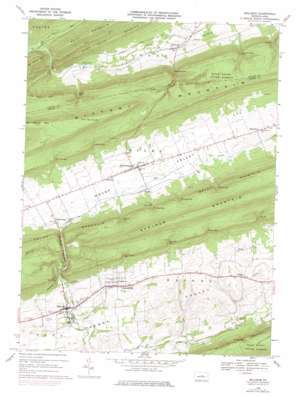
Millheim Topo Map Pennsylvania
To zoom in, hover over the map of Millheim
USGS Topo Quad 40077h4 - 1:24,000 scale
| Topo Map Name: | Millheim |
| USGS Topo Quad ID: | 40077h4 |
| Print Size: | ca. 21 1/4" wide x 27" high |
| Southeast Coordinates: | 40.875° N latitude / 77.375° W longitude |
| Map Center Coordinates: | 40.9375° N latitude / 77.4375° W longitude |
| U.S. State: | PA |
| Filename: | o40077h4.jpg |
| Download Map JPG Image: | Millheim topo map 1:24,000 scale |
| Map Type: | Topographic |
| Topo Series: | 7.5´ |
| Map Scale: | 1:24,000 |
| Source of Map Images: | United States Geological Survey (USGS) |
| Alternate Map Versions: |
Millheim PA 1968, updated 1971 Download PDF Buy paper map Millheim PA 1968, updated 1975 Download PDF Buy paper map Millheim PA 1968, updated 1984 Download PDF Buy paper map Millheim PA 1968, updated 1984 Download PDF Buy paper map Millheim PA 1977, updated 1979 Download PDF Buy paper map Millheim PA 2010 Download PDF Buy paper map Millheim PA 2013 Download PDF Buy paper map Millheim PA 2016 Download PDF Buy paper map |
1:24,000 Topo Quads surrounding Millheim
> Back to 40077e1 at 1:100,000 scale
> Back to 40076a1 at 1:250,000 scale
> Back to U.S. Topo Maps home
Millheim topo map: Gazetteer
Millheim: Airports
Brooks Airport elevation 388m 1272′Millheim: Gaps
Colvey Gap elevation 395m 1295′Colvey Narrows elevation 297m 974′
Detweiler Gap elevation 482m 1581′
Fox Gap elevation 445m 1459′
Gramley Gap elevation 458m 1502′
Kreamer Gap elevation 458m 1502′
Krouse Gap elevation 466m 1528′
Milheim Narrows elevation 360m 1181′
Rockville Gap elevation 479m 1571′
Schreckengast Gap elevation 457m 1499′
Schroyer Gap elevation 469m 1538′
Smullton Gap elevation 488m 1601′
Spangler Gap elevation 389m 1276′
Stover Gap elevation 488m 1601′
Waterhouse Gap elevation 458m 1502′
Wolf Gap elevation 429m 1407′
Youngs Gap elevation 487m 1597′
Millheim: Parks
State Game Lands Number 295 elevation 413m 1354′Millheim: Populated Places
Aaronsburg elevation 358m 1174′Fiedler elevation 346m 1135′
Millheim elevation 332m 1089′
Rebersburg elevation 392m 1286′
Rockville elevation 383m 1256′
Smullton elevation 381m 1250′
Spring Bank elevation 368m 1207′
Tylersville elevation 362m 1187′
Wolfs Store elevation 399m 1309′
Millheim: Springs
Seven Spring elevation 317m 1040′Tylersville Spring elevation 335m 1099′
Millheim: Streams
Bear Run elevation 300m 984′Cherry Run elevation 292m 958′
Phillips Creek elevation 353m 1158′
Millheim: Summits
Brush Mountain elevation 590m 1935′Little Kettle Mountain elevation 569m 1866′
The Winehead elevation 724m 2375′
Millheim: Valleys
Bletz Hollow elevation 398m 1305′Sugar Valley elevation 301m 987′
Millheim digital topo map on disk
Buy this Millheim topo map showing relief, roads, GPS coordinates and other geographical features, as a high-resolution digital map file on DVD:
Atlantic Coast (NY, NJ, PA, DE, MD, VA, NC)
Buy digital topo maps: Atlantic Coast (NY, NJ, PA, DE, MD, VA, NC)


