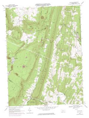
Saltillo Topo Map Pennsylvania
To zoom in, hover over the map of Saltillo
USGS Topo Quad 40078b1 - 1:24,000 scale
| Topo Map Name: | Saltillo |
| USGS Topo Quad ID: | 40078b1 |
| Print Size: | ca. 21 1/4" wide x 27" high |
| Southeast Coordinates: | 40.125° N latitude / 78° W longitude |
| Map Center Coordinates: | 40.1875° N latitude / 78.0625° W longitude |
| U.S. State: | PA |
| Filename: | o40078b1.jpg |
| Download Map JPG Image: | Saltillo topo map 1:24,000 scale |
| Map Type: | Topographic |
| Topo Series: | 7.5´ |
| Map Scale: | 1:24,000 |
| Source of Map Images: | United States Geological Survey (USGS) |
| Alternate Map Versions: |
Saltillo PA 1968, updated 1970 Download PDF Buy paper map Saltillo PA 1968, updated 1974 Download PDF Buy paper map Saltillo PA 1968, updated 1974 Download PDF Buy paper map Saltillo PA 1994, updated 1997 Download PDF Buy paper map Saltillo PA 2010 Download PDF Buy paper map Saltillo PA 2013 Download PDF Buy paper map Saltillo PA 2016 Download PDF Buy paper map |
1:24,000 Topo Quads surrounding Saltillo
> Back to 40078a1 at 1:100,000 scale
> Back to 40078a1 at 1:250,000 scale
> Back to U.S. Topo Maps home
Saltillo topo map: Gazetteer
Saltillo: Parks
State Game Lands Number 121 elevation 430m 1410′Saltillo: Populated Places
Cooks elevation 463m 1519′Fairview elevation 341m 1118′
Joller elevation 503m 1650′
Kimmel elevation 377m 1236′
Knightsville elevation 279m 915′
New Grenada elevation 272m 892′
Robertsdale elevation 544m 1784′
Saltillo elevation 242m 793′
Waterfall elevation 260m 853′
Saltillo: Ridges
Brier Ridge elevation 275m 902′Rocky Ridge elevation 530m 1738′
Saltillo: Streams
Roaring Run elevation 288m 944′Roaring Run elevation 268m 879′
West Branch Roaring Run elevation 305m 1000′
Yellow Branch elevation 464m 1522′
Saltillo: Summits
Cave Hill elevation 365m 1197′Coles Summit elevation 533m 1748′
Grave Mountain elevation 650m 2132′
Round Knob elevation 699m 2293′
Saltillo: Trails
Gracey Trail elevation 279m 915′Saltillo: Valleys
Coles Valley elevation 279m 915′Poplar Hollow elevation 250m 820′
Shore Valley elevation 254m 833′
Trough Creek Valley elevation 368m 1207′
Saltillo digital topo map on disk
Buy this Saltillo topo map showing relief, roads, GPS coordinates and other geographical features, as a high-resolution digital map file on DVD:


