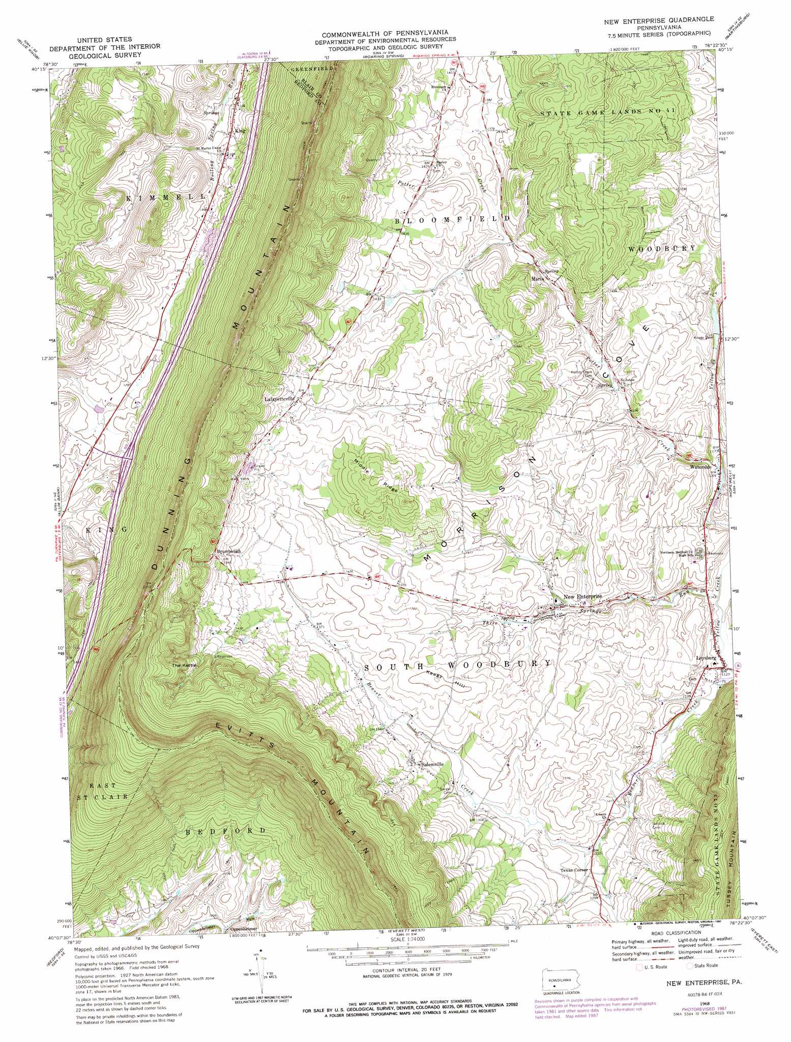
New Enterprise Topo Map Pennsylvania
To zoom in, hover over the map of New Enterprise
USGS Topo Quad 40078b4 - 1:24,000 scale
| Topo Map Name: | New Enterprise |
| USGS Topo Quad ID: | 40078b4 |
| Print Size: | ca. 21 1/4" wide x 27" high |
| Southeast Coordinates: | 40.125° N latitude / 78.375° W longitude |
| Map Center Coordinates: | 40.1875° N latitude / 78.4375° W longitude |
| U.S. State: | PA |
| Filename: | o40078b4.jpg |
| Download Map JPG Image: | New Enterprise topo map 1:24,000 scale |
| Map Type: | Topographic |
| Topo Series: | 7.5´ |
| Map Scale: | 1:24,000 |
| Source of Map Images: | United States Geological Survey (USGS) |
| Alternate Map Versions: |
New Enterprise PA 1968, updated 1970 Download PDF Buy paper map New Enterprise PA 1968, updated 1974 Download PDF Buy paper map New Enterprise PA 1968, updated 1987 Download PDF Buy paper map New Enterprise PA 2010 Download PDF Buy paper map New Enterprise PA 2013 Download PDF Buy paper map New Enterprise PA 2016 Download PDF Buy paper map |
1:24,000 Topo Quads surrounding New Enterprise
Ebensburg |
Cresson |
Hollidaysburg |
Frankstown |
Williamsburg |
Beaverdale |
Blue Knob |
Roaring Spring |
Martinsburg |
Entriken |
Ogletown |
Alum Bank |
New Enterprise |
Hopewell |
Saxton |
Schellsburg |
Bedford |
Everett West |
Everett East |
Wells Tannery |
Buffalo Mills |
Rainsburg |
Clearville |
Mench |
Breezewood |
> Back to 40078a1 at 1:100,000 scale
> Back to 40078a1 at 1:250,000 scale
> Back to U.S. Topo Maps home
New Enterprise topo map: Gazetteer
New Enterprise: Basins
The Kettle elevation 522m 1712′New Enterprise: Dams
Keagy Dam elevation 373m 1223′New Enterprise: Parks
State Game Lands Number 41 elevation 474m 1555′New Enterprise: Populated Places
Brumbaugh elevation 481m 1578′King elevation 407m 1335′
Lafayetteville elevation 468m 1535′
Loysburg elevation 339m 1112′
Maria elevation 399m 1309′
New Enterprise elevation 384m 1259′
Salemville elevation 409m 1341′
Texas Corner elevation 382m 1253′
Waterside elevation 363m 1190′
New Enterprise: Ridges
Middle Ridge elevation 490m 1607′New Enterprise: Streams
Hickory Bottom Creek elevation 362m 1187′Potter Creek elevation 364m 1194′
Three Springs Run elevation 344m 1128′
New Enterprise: Summits
Dunning Mountain elevation 656m 2152′Keagy Hill elevation 432m 1417′
New Enterprise digital topo map on disk
Buy this New Enterprise topo map showing relief, roads, GPS coordinates and other geographical features, as a high-resolution digital map file on DVD:
 map DVD")