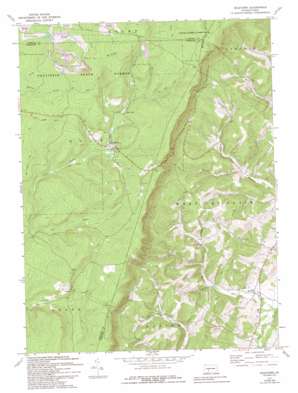
Ogletown Topo Map Pennsylvania
To zoom in, hover over the map of Ogletown
USGS Topo Quad 40078b6 - 1:24,000 scale
| Topo Map Name: | Ogletown |
| USGS Topo Quad ID: | 40078b6 |
| Print Size: | ca. 21 1/4" wide x 27" high |
| Southeast Coordinates: | 40.125° N latitude / 78.625° W longitude |
| Map Center Coordinates: | 40.1875° N latitude / 78.6875° W longitude |
| U.S. State: | PA |
| Filename: | o40078b6.jpg |
| Download Map JPG Image: | Ogletown topo map 1:24,000 scale |
| Map Type: | Topographic |
| Topo Series: | 7.5´ |
| Map Scale: | 1:24,000 |
| Source of Map Images: | United States Geological Survey (USGS) |
| Alternate Map Versions: |
Ogletown PA 1971, updated 1973 Download PDF Buy paper map Ogletown PA 1971, updated 1976 Download PDF Buy paper map Ogletown PA 1971, updated 1982 Download PDF Buy paper map Ogletown PA 1971, updated 1994 Download PDF Buy paper map Ogletown PA 1977, updated 1979 Download PDF Buy paper map Ogletown PA 2010 Download PDF Buy paper map Ogletown PA 2013 Download PDF Buy paper map Ogletown PA 2016 Download PDF Buy paper map |
1:24,000 Topo Quads surrounding Ogletown
> Back to 40078a1 at 1:100,000 scale
> Back to 40078a1 at 1:250,000 scale
> Back to U.S. Topo Maps home
Ogletown topo map: Gazetteer
Ogletown: Dams
Galion Bay Dam elevation 774m 2539′Lake Rene Dam elevation 767m 2516′
Lake Sabula Dam elevation 473m 1551′
Wolf Creek Dam elevation 733m 2404′
Ogletown: Forests
Babcock State Forest elevation 834m 2736′Gallitzin State Forest elevation 732m 2401′
Ogletown: Populated Places
Crumb elevation 740m 2427′Ogletown elevation 718m 2355′
Ryot elevation 376m 1233′
Ogletown: Post Offices
Felix Post Office (historical) elevation 721m 2365′Ogletown: Reservoirs
Lake Rene elevation 767m 2516′Pine Lake elevation 716m 2349′
Ogletown: Ridges
Pot Ridge elevation 823m 2700′Ogletown: Streams
Callihan Creek elevation 423m 1387′Cub Run elevation 691m 2267′
Gordon Creek elevation 418m 1371′
Ryot Run elevation 366m 1200′
Ogletown: Valleys
Calvary Hollow elevation 416m 1364′Ogletown digital topo map on disk
Buy this Ogletown topo map showing relief, roads, GPS coordinates and other geographical features, as a high-resolution digital map file on DVD:


