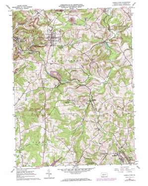
Carrolltown Topo Map Pennsylvania
To zoom in, hover over the map of Carrolltown
USGS Topo Quad 40078e6 - 1:24,000 scale
| Topo Map Name: | Carrolltown |
| USGS Topo Quad ID: | 40078e6 |
| Print Size: | ca. 21 1/4" wide x 27" high |
| Southeast Coordinates: | 40.5° N latitude / 78.625° W longitude |
| Map Center Coordinates: | 40.5625° N latitude / 78.6875° W longitude |
| U.S. State: | PA |
| Filename: | o40078e6.jpg |
| Download Map JPG Image: | Carrolltown topo map 1:24,000 scale |
| Map Type: | Topographic |
| Topo Series: | 7.5´ |
| Map Scale: | 1:24,000 |
| Source of Map Images: | United States Geological Survey (USGS) |
| Alternate Map Versions: |
Carrolltown PA 1961, updated 1963 Download PDF Buy paper map Carrolltown PA 1961, updated 1973 Download PDF Buy paper map Carrolltown PA 2010 Download PDF Buy paper map Carrolltown PA 2013 Download PDF Buy paper map Carrolltown PA 2016 Download PDF Buy paper map |
1:24,000 Topo Quads surrounding Carrolltown
> Back to 40078e1 at 1:100,000 scale
> Back to 40078a1 at 1:250,000 scale
> Back to U.S. Topo Maps home
Carrolltown topo map: Gazetteer
Carrolltown: Airports
Carrolltown Airport elevation 579m 1899′Morchesky Airport elevation 628m 2060′
Strittmatter Airport elevation 629m 2063′
Carrolltown: Dams
West Carrol Township Water Sewer Authority Dam elevation 615m 2017′Carrolltown: Mines
Jones Portal elevation 651m 2135′Carrolltown: Populated Places
Bakers Crossroad elevation 643m 2109′Bakerton elevation 517m 1696′
Bradley Junction elevation 553m 1814′
Carrolltown elevation 663m 2175′
Carrolltown Road elevation 564m 1850′
Driscoll elevation 552m 1811′
Eckenrode Mill elevation 535m 1755′
Elmora elevation 500m 1640′
Foxburg elevation 569m 1866′
Lonely Acres elevation 594m 1948′
Loretto elevation 595m 1952′
Loretto Road elevation 625m 2050′
Winterset elevation 665m 2181′
Carrolltown: Post Offices
Loretto Post Office (historical) elevation 595m 1952′Carrolltown: Reservoirs
Bakerton Reservoir elevation 551m 1807′Carrolltown Reservoir elevation 599m 1965′
Carrolltown: Ridges
Dividing Ridge elevation 635m 2083′Carrolltown: Streams
Duclos Run elevation 534m 1751′Laurel Lick Run elevation 542m 1778′
Carrolltown digital topo map on disk
Buy this Carrolltown topo map showing relief, roads, GPS coordinates and other geographical features, as a high-resolution digital map file on DVD:


