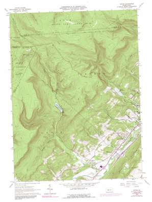
Tipton Topo Map Pennsylvania
To zoom in, hover over the map of Tipton
USGS Topo Quad 40078f3 - 1:24,000 scale
| Topo Map Name: | Tipton |
| USGS Topo Quad ID: | 40078f3 |
| Print Size: | ca. 21 1/4" wide x 27" high |
| Southeast Coordinates: | 40.625° N latitude / 78.25° W longitude |
| Map Center Coordinates: | 40.6875° N latitude / 78.3125° W longitude |
| U.S. State: | PA |
| Filename: | o40078f3.jpg |
| Download Map JPG Image: | Tipton topo map 1:24,000 scale |
| Map Type: | Topographic |
| Topo Series: | 7.5´ |
| Map Scale: | 1:24,000 |
| Source of Map Images: | United States Geological Survey (USGS) |
| Alternate Map Versions: |
Tipton PA 1963, updated 1965 Download PDF Buy paper map Tipton PA 1963, updated 1973 Download PDF Buy paper map Tipton PA 1963, updated 1991 Download PDF Buy paper map Tipton PA 2010 Download PDF Buy paper map Tipton PA 2013 Download PDF Buy paper map Tipton PA 2016 Download PDF Buy paper map |
1:24,000 Topo Quads surrounding Tipton
> Back to 40078e1 at 1:100,000 scale
> Back to 40078a1 at 1:250,000 scale
> Back to U.S. Topo Maps home
Tipton topo map: Gazetteer
Tipton: Airports
Peterson Memorial Field elevation 295m 967′Tipton: Dams
Tipton Dam elevation 414m 1358′Tyrone Dam Number One elevation 362m 1187′
Tipton: Parks
State Game Lands Number 60 elevation 759m 2490′Tipton: Populated Places
Charlottsville elevation 289m 948′Gray elevation 301m 987′
Grazierville elevation 287m 941′
Tipton elevation 304m 997′
Tipton: Reservoirs
Tipton Reservoir elevation 422m 1384′Tyrone Reservoir elevation 361m 1184′
Tyrone Reservoir Number One elevation 362m 1187′
Tyrone Reservoir Number Two elevation 368m 1207′
Tipton: Springs
Cold Spring elevation 288m 944′Tipton: Streams
Hutchinson Run elevation 287m 941′Loup Run elevation 401m 1315′
Three Springs Run elevation 444m 1456′
Tipton Run elevation 292m 958′
Tipton: Summits
Lost Mountain elevation 804m 2637′Tipton: Valleys
Fry Hollow elevation 314m 1030′Mulligan Hollow elevation 372m 1220′
Tipton digital topo map on disk
Buy this Tipton topo map showing relief, roads, GPS coordinates and other geographical features, as a high-resolution digital map file on DVD:


