Sandy Ridge Topo Map Pennsylvania
To zoom in, hover over the map of Sandy Ridge
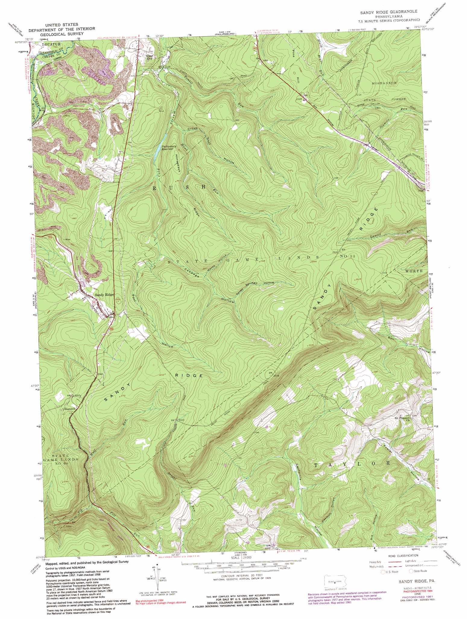
USGS Topo Quad 40078g2 - 1:24,000 scale
| Topo Map Name: | Sandy Ridge |
| USGS Topo Quad ID: | 40078g2 |
| Print Size: | ca. 21 1/4" wide x 27" high |
| Southeast Coordinates: | 40.75° N latitude / 78.125° W longitude |
| Map Center Coordinates: | 40.8125° N latitude / 78.1875° W longitude |
| U.S. State: | PA |
| Filename: | o40078g2.jpg |
| Download Map JPG Image: | Sandy Ridge topo map 1:24,000 scale |
| Map Type: | Topographic |
| Topo Series: | 7.5´ |
| Map Scale: | 1:24,000 |
| Source of Map Images: | United States Geological Survey (USGS) |
| Alternate Map Versions: |
Sandy Ridge PA 1958, updated 1960 Download PDF Buy paper map Sandy Ridge PA 1958, updated 1960 Download PDF Buy paper map Sandy Ridge PA 1958, updated 1972 Download PDF Buy paper map Sandy Ridge PA 1958, updated 1973 Download PDF Buy paper map Sandy Ridge PA 1958, updated 1982 Download PDF Buy paper map Sandy Ridge PA 1958, updated 1990 Download PDF Buy paper map Sandy Ridge PA 1994, updated 1997 Download PDF Buy paper map Sandy Ridge PA 2010 Download PDF Buy paper map Sandy Ridge PA 2013 Download PDF Buy paper map Sandy Ridge PA 2016 Download PDF Buy paper map |
1:24,000 Topo Quads surrounding Sandy Ridge
Clearfield |
Lecontes Mills |
Frenchville |
Karthaus |
Snow Shoe |
Glen Richey |
Wallaceton |
Philipsburg |
Black Moshannon |
Bear Knob |
Ramey |
Houtzdale |
Sandy Ridge |
Port Matilda |
Julian |
Blandburg |
Tipton |
Tyrone |
Franklinville |
Pine Grove Mills |
Altoona |
Bellwood |
Spruce Creek |
Alexandria |
Donation |
> Back to 40078e1 at 1:100,000 scale
> Back to 40078a1 at 1:250,000 scale
> Back to U.S. Topo Maps home
Sandy Ridge topo map: Gazetteer
Sandy Ridge: Dams
Upper Dam elevation 494m 1620′Sandy Ridge: Parks
State Game Lands Number 33 elevation 677m 2221′Sandy Ridge: Populated Places
Glass City elevation 510m 1673′Sandy Ridge elevation 568m 1863′
Sandy Ridge: Reservoirs
Philipsburg Reservoir elevation 496m 1627′Sandy Ridge: Ridges
Horseback Ridge elevation 567m 1860′Sandy Ridge elevation 775m 2542′
Sandy Ridge: Streams
Cabbage Hollow Run elevation 529m 1735′Hawk Run elevation 488m 1601′
Shimel Run elevation 437m 1433′
Tomtit Run elevation 474m 1555′
Wolf Run elevation 464m 1522′
Sandy Ridge: Summits
Pine Hill elevation 649m 2129′Sandy Ridge: Trails
Slide Hollow Trail elevation 613m 2011′Sandy Ridge: Valleys
Cabbage Hollow elevation 535m 1755′Crowns Nest Hollow elevation 501m 1643′
Deepcut Hollow elevation 377m 1236′
Horse Hollow elevation 562m 1843′
Pool Hollow elevation 556m 1824′
Seven Springs Hollow elevation 590m 1935′
Sandy Ridge digital topo map on disk
Buy this Sandy Ridge topo map showing relief, roads, GPS coordinates and other geographical features, as a high-resolution digital map file on DVD:
 map DVD")