Somerset Topo Map Pennsylvania
To zoom in, hover over the map of Somerset
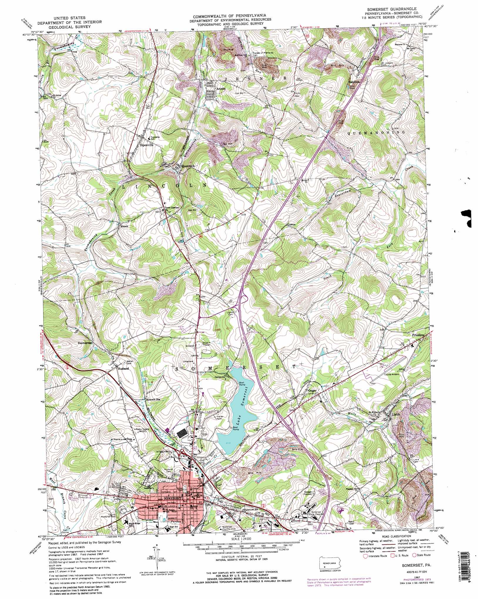
USGS Topo Quad 40079a1 - 1:24,000 scale
| Topo Map Name: | Somerset |
| USGS Topo Quad ID: | 40079a1 |
| Print Size: | ca. 21 1/4" wide x 27" high |
| Southeast Coordinates: | 40° N latitude / 79° W longitude |
| Map Center Coordinates: | 40.0625° N latitude / 79.0625° W longitude |
| U.S. State: | PA |
| Filename: | o40079a1.jpg |
| Download Map JPG Image: | Somerset topo map 1:24,000 scale |
| Map Type: | Topographic |
| Topo Series: | 7.5´ |
| Map Scale: | 1:24,000 |
| Source of Map Images: | United States Geological Survey (USGS) |
| Alternate Map Versions: |
Somerset PA 1967, updated 1971 Download PDF Buy paper map Somerset PA 1967, updated 1973 Download PDF Buy paper map Somerset PA 1967, updated 1974 Download PDF Buy paper map Somerset PA 1967, updated 1989 Download PDF Buy paper map Somerset PA 1967, updated 1989 Download PDF Buy paper map Somerset PA 1967, updated 1989 Download PDF Buy paper map Somerset PA 1977, updated 1979 Download PDF Buy paper map Somerset PA 2010 Download PDF Buy paper map Somerset PA 2013 Download PDF Buy paper map Somerset PA 2016 Download PDF Buy paper map |
1:24,000 Topo Quads surrounding Somerset
Derry |
Wilpen |
Rachelwood |
Johnstown |
Geistown |
Stahlstown |
Ligonier |
Boswell |
Hooversville |
Windber |
Seven Springs |
Bakersville |
Somerset |
Stoystown |
Central City |
Kingwood |
Rockwood |
Murdock |
Berlin |
New Baltimore |
Confluence |
Markleton |
Meyersdale |
Wittenberg |
Fairhope |
> Back to 40079a1 at 1:100,000 scale
> Back to 40078a1 at 1:250,000 scale
> Back to U.S. Topo Maps home
Somerset topo map: Gazetteer
Somerset: Airports
Somerset County Airport elevation 683m 2240′Somerset: Dams
Coxes Creek Dam elevation 647m 2122′Oneida Mining Company Dam elevation 713m 2339′
Somerset: Populated Places
Acosta elevation 566m 1856′Enoch elevation 594m 1948′
Geiger elevation 671m 2201′
Gideon elevation 622m 2040′
Husband elevation 670m 2198′
Listie elevation 645m 2116′
Quecreek elevation 590m 1935′
Ralphton elevation 612m 2007′
Sipesville elevation 635m 2083′
Snydersville elevation 636m 2086′
Somerset elevation 669m 2194′
Zimmerman elevation 612m 2007′
Somerset: Post Offices
Sipesville Post Office (historical) elevation 635m 2083′Somerset: Reservoirs
Lake Somerset elevation 642m 2106′Somerset: Streams
South Fork Beaverdam Creek elevation 563m 1847′Somerset digital topo map on disk
Buy this Somerset topo map showing relief, roads, GPS coordinates and other geographical features, as a high-resolution digital map file on DVD:
 map DVD")