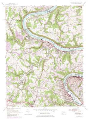
Monongahela Topo Map Pennsylvania
To zoom in, hover over the map of Monongahela
USGS Topo Quad 40079b8 - 1:24,000 scale
| Topo Map Name: | Monongahela |
| USGS Topo Quad ID: | 40079b8 |
| Print Size: | ca. 21 1/4" wide x 27" high |
| Southeast Coordinates: | 40.125° N latitude / 79.875° W longitude |
| Map Center Coordinates: | 40.1875° N latitude / 79.9375° W longitude |
| U.S. State: | PA |
| Filename: | o40079b8.jpg |
| Download Map JPG Image: | Monongahela topo map 1:24,000 scale |
| Map Type: | Topographic |
| Topo Series: | 7.5´ |
| Map Scale: | 1:24,000 |
| Source of Map Images: | United States Geological Survey (USGS) |
| Alternate Map Versions: |
Monongahela PA 1954, updated 1955 Download PDF Buy paper map Monongahela PA 1954, updated 1970 Download PDF Buy paper map Monongahela PA 1954, updated 1979 Download PDF Buy paper map Monongahela PA 1954, updated 1979 Download PDF Buy paper map Monongahela PA 1993, updated 1999 Download PDF Buy paper map Monongahela PA 2010 Download PDF Buy paper map Monongahela PA 2013 Download PDF Buy paper map Monongahela PA 2016 Download PDF Buy paper map |
1:24,000 Topo Quads surrounding Monongahela
> Back to 40079a1 at 1:100,000 scale
> Back to 40078a1 at 1:250,000 scale
> Back to U.S. Topo Maps home
Monongahela topo map: Gazetteer
Monongahela: Airports
Aldrich Airport elevation 305m 1000′Lee Norse Number One Heliport elevation 237m 777′
Monongahela: Beaches
Redds Beach elevation 344m 1128′Monongahela: Bridges
Monongahela City Bridge elevation 221m 725′Monongahela: Dams
Silt Pond A Dam elevation 332m 1089′Silt Pond B Dam elevation 339m 1112′
Monongahela: Populated Places
Baidland elevation 303m 994′Black Diamond elevation 238m 780′
Bunola elevation 241m 790′
Charleroi elevation 237m 777′
Courtney elevation 248m 813′
Cracker Jack elevation 261m 856′
Crookham elevation 247m 810′
East Charleroi elevation 242m 793′
East Monongahela elevation 230m 754′
Elben elevation 248m 813′
Eldora elevation 321m 1053′
Elkhorn elevation 233m 764′
Fisher elevation 371m 1217′
Froman elevation 327m 1072′
Frye elevation 239m 784′
Gallatin elevation 233m 764′
Ghennes Heights elevation 334m 1095′
Gibson elevation 290m 951′
Gibsonton elevation 237m 777′
Ginger Hill elevation 355m 1164′
Hazel Kirk elevation 241m 790′
Hilldale elevation 266m 872′
Huston Run elevation 221m 725′
Jonestown elevation 312m 1023′
Lockview elevation 289m 948′
Manown elevation 234m 767′
Monessen elevation 344m 1128′
Monongahela elevation 231m 757′
New Eagle elevation 240m 787′
North Charleroi elevation 247m 810′
Redds Mill elevation 269m 882′
River Hill elevation 336m 1102′
River View elevation 239m 784′
Riverview elevation 278m 912′
Rogers Stop elevation 309m 1013′
Sampson elevation 362m 1187′
Shire Oaks elevation 243m 797′
Sudan elevation 284m 931′
Sunny Side elevation 229m 751′
Twin Bridges elevation 280m 918′
Van Voorhis elevation 287m 941′
Victory Hills elevation 265m 869′
Wallace elevation 249m 816′
Warner elevation 317m 1040′
Wickerham Manor elevation 375m 1230′
Monongahela: Post Offices
Charleroi Post Office elevation 236m 774′Monessen Post Office elevation 236m 774′
Monongahela Post Office elevation 238m 780′
New Eagle Post Office elevation 233m 764′
Monongahela: Reservoirs
Monongahela River Pool Four elevation 232m 761′Orlando Lake elevation 306m 1003′
Silt Pond A elevation 332m 1089′
Silt Pond B elevation 339m 1112′
Tri-Cities Reservoir elevation 324m 1062′
Monongahela: Streams
Bunola Run elevation 224m 734′Dry Run elevation 226m 741′
Froman Run elevation 241m 790′
Huston Run elevation 221m 725′
Kelly Run elevation 226m 741′
Maple Creek elevation 230m 754′
Mingo Creek elevation 224m 734′
Pigeon Creek elevation 224m 734′
Sawmill Creek elevation 249m 816′
South Branch Maple Creek elevation 230m 754′
Speers Run elevation 230m 754′
Sunfish Run elevation 221m 725′
Taylors Run elevation 229m 751′
Monongahela: Tunnels
Temple Tunnel elevation 363m 1190′Vang Tunnel elevation 319m 1046′
Monongahela digital topo map on disk
Buy this Monongahela topo map showing relief, roads, GPS coordinates and other geographical features, as a high-resolution digital map file on DVD:


