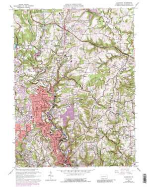
Glenshaw Topo Map Pennsylvania
To zoom in, hover over the map of Glenshaw
USGS Topo Quad 40079e8 - 1:24,000 scale
| Topo Map Name: | Glenshaw |
| USGS Topo Quad ID: | 40079e8 |
| Print Size: | ca. 21 1/4" wide x 27" high |
| Southeast Coordinates: | 40.5° N latitude / 79.875° W longitude |
| Map Center Coordinates: | 40.5625° N latitude / 79.9375° W longitude |
| U.S. State: | PA |
| Filename: | o40079e8.jpg |
| Download Map JPG Image: | Glenshaw topo map 1:24,000 scale |
| Map Type: | Topographic |
| Topo Series: | 7.5´ |
| Map Scale: | 1:24,000 |
| Source of Map Images: | United States Geological Survey (USGS) |
| Alternate Map Versions: |
Glenshaw PA 1953, updated 1955 Download PDF Buy paper map Glenshaw PA 1960, updated 1961 Download PDF Buy paper map Glenshaw PA 1960, updated 1966 Download PDF Buy paper map Glenshaw PA 1960, updated 1971 Download PDF Buy paper map Glenshaw PA 1960, updated 1979 Download PDF Buy paper map Glenshaw PA 1960, updated 1988 Download PDF Buy paper map Glenshaw PA 1960, updated 1988 Download PDF Buy paper map Glenshaw PA 1993, updated 1999 Download PDF Buy paper map Glenshaw PA 2010 Download PDF Buy paper map Glenshaw PA 2013 Download PDF Buy paper map Glenshaw PA 2016 Download PDF Buy paper map |
1:24,000 Topo Quads surrounding Glenshaw
> Back to 40079e1 at 1:100,000 scale
> Back to 40078a1 at 1:250,000 scale
> Back to U.S. Topo Maps home
Glenshaw topo map: Gazetteer
Glenshaw: Airports
Cedar Run Airport elevation 354m 1161′Nardo Airport elevation 332m 1089′
Glenshaw: Crossings
Interchange 39 elevation 334m 1095′Pennsylvania Turnpike Interchange 4 elevation 329m 1079′
Glenshaw: Dams
Pine Creek Dam elevation 292m 958′Glenshaw: Lakes
Lake Ottilie elevation 317m 1040′Glenshaw: Parks
Hartwood Acres Park elevation 393m 1289′State Game Lands Number 77 elevation 258m 846′
Glenshaw: Populated Places
Allison Park elevation 267m 875′Allison Park elevation 262m 859′
Bryant elevation 329m 1079′
Dorseyville elevation 313m 1026′
Elfinwild elevation 255m 836′
Etna elevation 227m 744′
Evergreen elevation 266m 872′
Fawn Haven Number One elevation 343m 1125′
Fawn Haven Number Two elevation 350m 1148′
Fox Chapel elevation 299m 980′
Glenshaw elevation 332m 1089′
Hardy elevation 303m 994′
Park View elevation 354m 1161′
Sample elevation 272m 892′
Sharpe Hill elevation 334m 1095′
Talley Cavey elevation 348m 1141′
Undercliff elevation 230m 754′
Wildwood elevation 312m 1023′
Wittmer elevation 234m 767′
Glenshaw: Post Offices
Allison Park Post Office elevation 359m 1177′Gibsonia Post Office elevation 292m 958′
Glenshaw Post Office elevation 244m 800′
Glenshaw: Reservoirs
Campbell Lake elevation 315m 1033′Glade Lake elevation 281m 921′
Hardies Lake elevation 300m 984′
North Park Lake elevation 292m 958′
Glenshaw: Streams
Cedar Run elevation 259m 849′Coxtown Run elevation 255m 836′
Crouse Run elevation 272m 892′
Dawson Run elevation 281m 921′
Glade Run elevation 269m 882′
Gourdhead Run elevation 261m 856′
Little Pine Creek elevation 238m 780′
Little Pine Creek elevation 228m 748′
McCaskin Run elevation 271m 889′
Montour Run elevation 285m 935′
Nelson Run elevation 261m 856′
Shafers Run elevation 268m 879′
Stony Camp Run elevation 261m 856′
West Branch Deer Creek elevation 285m 935′
Willow Run elevation 280m 918′
Glenshaw: Valleys
Cold Valley elevation 271m 889′Glenshaw digital topo map on disk
Buy this Glenshaw topo map showing relief, roads, GPS coordinates and other geographical features, as a high-resolution digital map file on DVD:


