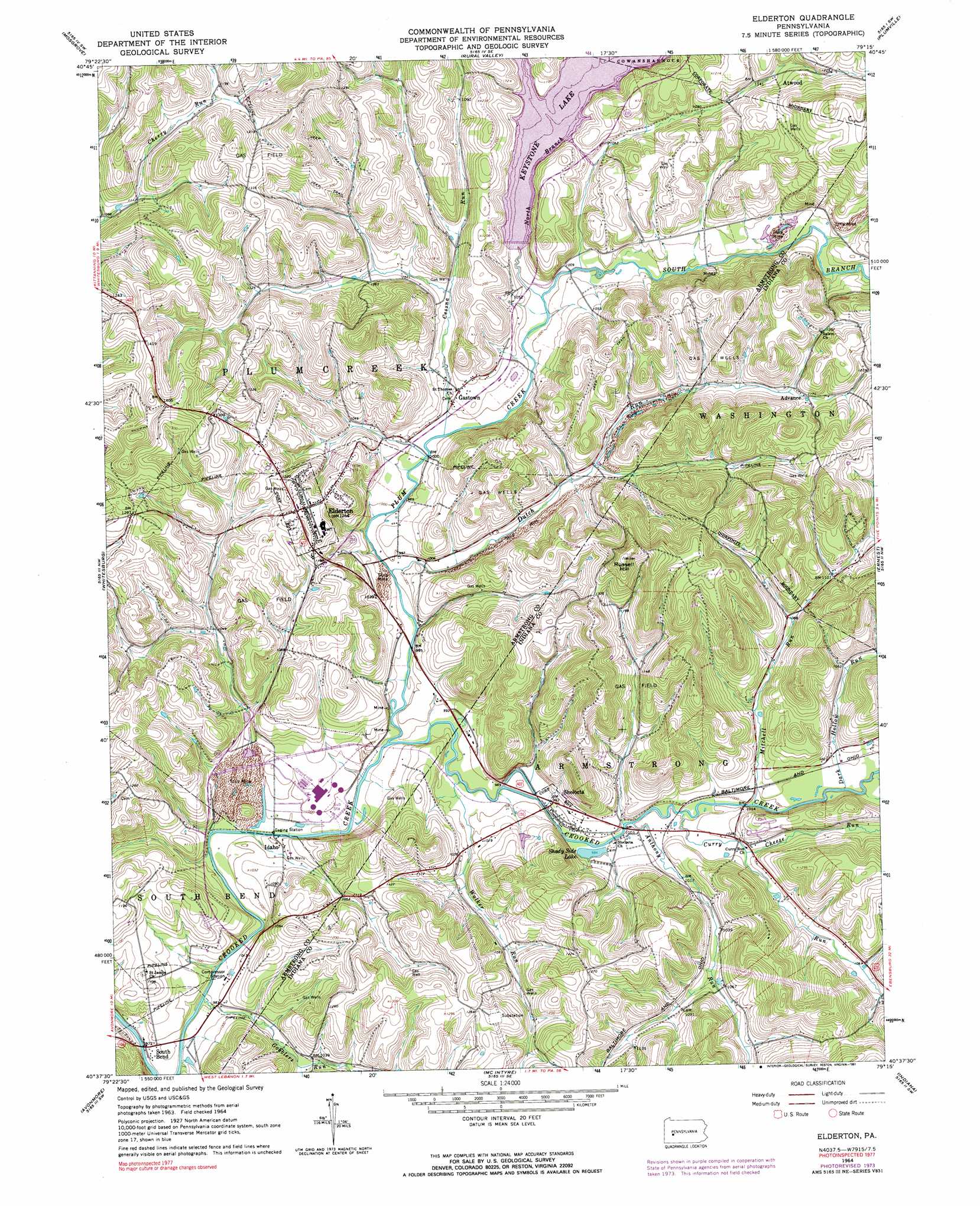
Elderton Topo Map Pennsylvania
To zoom in, hover over the map of Elderton
USGS Topo Quad 40079f3 - 1:24,000 scale
| Topo Map Name: | Elderton |
| USGS Topo Quad ID: | 40079f3 |
| Print Size: | ca. 21 1/4" wide x 27" high |
| Southeast Coordinates: | 40.625° N latitude / 79.25° W longitude |
| Map Center Coordinates: | 40.6875° N latitude / 79.3125° W longitude |
| U.S. State: | PA |
| Filename: | o40079f3.jpg |
| Download Map JPG Image: | Elderton topo map 1:24,000 scale |
| Map Type: | Topographic |
| Topo Series: | 7.5´ |
| Map Scale: | 1:24,000 |
| Source of Map Images: | United States Geological Survey (USGS) |
| Alternate Map Versions: |
Elderton PA 1964, updated 1966 Download PDF Buy paper map Elderton PA 1964, updated 1974 Download PDF Buy paper map Elderton PA 1964, updated 1991 Download PDF Buy paper map Elderton PA 2010 Download PDF Buy paper map Elderton PA 2013 Download PDF Buy paper map Elderton PA 2016 Download PDF Buy paper map |
1:24,000 Topo Quads surrounding Elderton
East Brady |
Templeton |
Distant |
Dayton |
Valier |
Kittanning |
Mosgrove |
Rural Valley |
Plumville |
Marion Center |
Leechburg |
Whitesburg |
Elderton |
Ernest |
Clymer |
Vandergrift |
Avonmore |
Mcintyre |
Indiana |
Brush Valley |
Slickville |
Saltsburg |
Blairsville |
Bolivar |
New Florence |
> Back to 40079e1 at 1:100,000 scale
> Back to 40078a1 at 1:250,000 scale
> Back to U.S. Topo Maps home
Elderton topo map: Gazetteer
Elderton: Airports
Flying O Airport elevation 376m 1233′Elderton: Dams
Keystone Station Dam elevation 353m 1158′Sample Run Dam elevation 322m 1056′
Elderton: Populated Places
Advance elevation 357m 1171′Elderton elevation 387m 1269′
Gastown elevation 315m 1033′
Idaho elevation 305m 1000′
Shelocta elevation 301m 987′
South Bend elevation 293m 961′
Elderton: Reservoirs
Keystone Lake elevation 328m 1076′Sample Reservoir elevation 322m 1056′
Shady Side Lake elevation 303m 994′
Elderton: Streams
Anthony Run elevation 305m 1000′Cessna Run elevation 302m 990′
Cheese Run elevation 310m 1017′
Curry Run elevation 305m 1000′
Dark Hollow Run elevation 305m 1000′
Dutch Run elevation 299m 980′
Gobblers Run elevation 292m 958′
Mitchell Run elevation 304m 997′
North Branch Plum Creek elevation 303m 994′
Plum Creek elevation 298m 977′
South Branch Plum Creek elevation 303m 994′
Walker Run elevation 298m 977′
Elderton: Summits
Russell Hill elevation 472m 1548′Elderton digital topo map on disk
Buy this Elderton topo map showing relief, roads, GPS coordinates and other geographical features, as a high-resolution digital map file on DVD:
 map DVD")