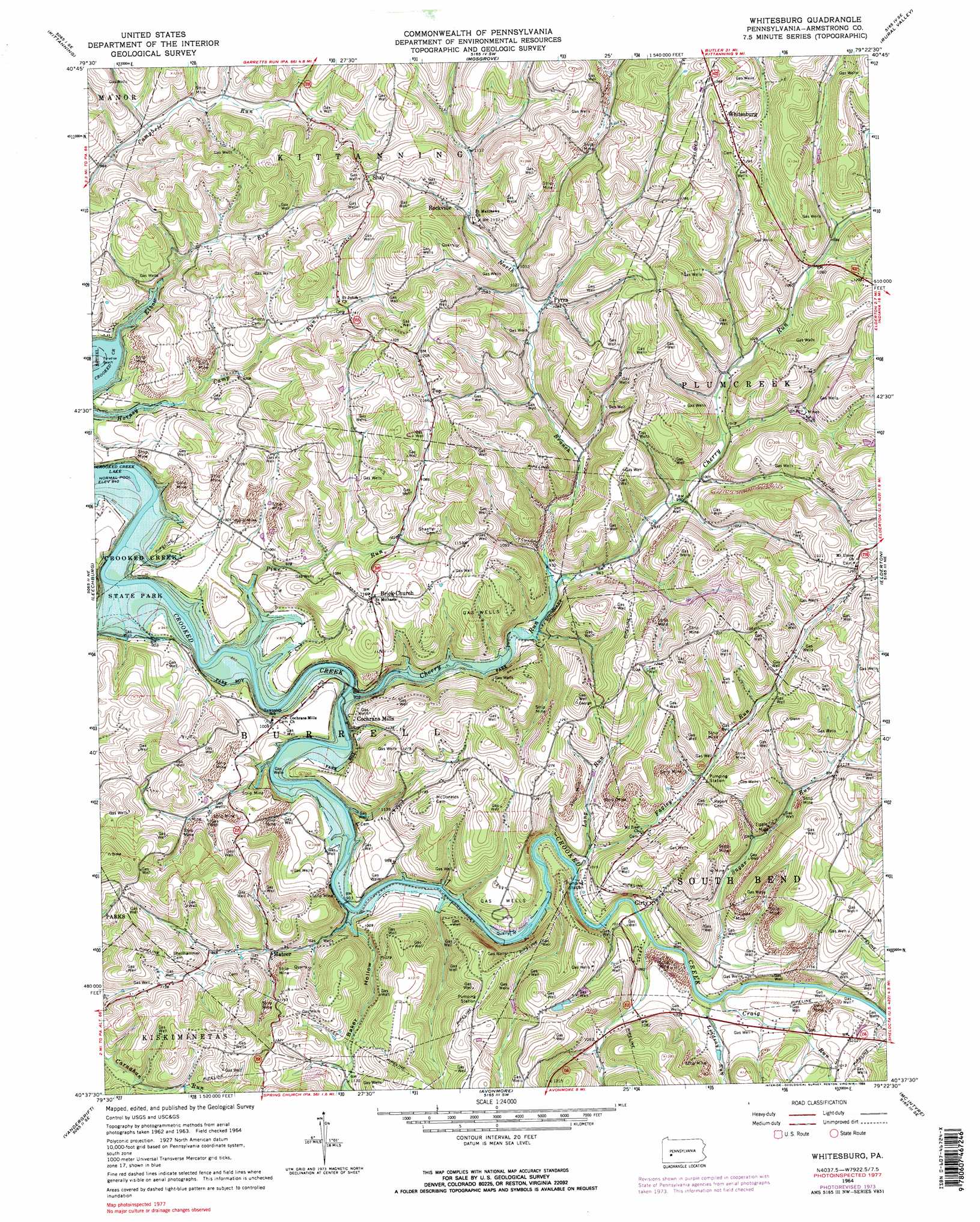
Whitesburg Topo Map Pennsylvania
To zoom in, hover over the map of Whitesburg
USGS Topo Quad 40079f4 - 1:24,000 scale
| Topo Map Name: | Whitesburg |
| USGS Topo Quad ID: | 40079f4 |
| Print Size: | ca. 21 1/4" wide x 27" high |
| Southeast Coordinates: | 40.625° N latitude / 79.375° W longitude |
| Map Center Coordinates: | 40.6875° N latitude / 79.4375° W longitude |
| U.S. State: | PA |
| Filename: | o40079f4.jpg |
| Download Map JPG Image: | Whitesburg topo map 1:24,000 scale |
| Map Type: | Topographic |
| Topo Series: | 7.5´ |
| Map Scale: | 1:24,000 |
| Source of Map Images: | United States Geological Survey (USGS) |
| Alternate Map Versions: |
Whitesburg PA 1964, updated 1966 Download PDF Buy paper map Whitesburg PA 1964, updated 1973 Download PDF Buy paper map Whitesburg PA 1964, updated 1984 Download PDF Buy paper map Whitesburg PA 1964, updated 1984 Download PDF Buy paper map Whitesburg PA 2010 Download PDF Buy paper map Whitesburg PA 2013 Download PDF Buy paper map Whitesburg PA 2016 Download PDF Buy paper map |
1:24,000 Topo Quads surrounding Whitesburg
Chicora |
East Brady |
Templeton |
Distant |
Dayton |
Worthington |
Kittanning |
Mosgrove |
Rural Valley |
Plumville |
Freeport |
Leechburg |
Whitesburg |
Elderton |
Ernest |
New Kensington East |
Vandergrift |
Avonmore |
Mcintyre |
Indiana |
Murrysville |
Slickville |
Saltsburg |
Blairsville |
Bolivar |
> Back to 40079e1 at 1:100,000 scale
> Back to 40078a1 at 1:250,000 scale
> Back to U.S. Topo Maps home
Whitesburg topo map: Gazetteer
Whitesburg: Beaches
Paradise Beach elevation 268m 879′Whitesburg: Parks
Crooked Creek Lake Recreation Area elevation 324m 1062′Whitesburg: Populated Places
Brick Church elevation 363m 1190′Cochrans Mills elevation 320m 1049′
Girty elevation 303m 994′
Mateer elevation 305m 1000′
Pyrra elevation 322m 1056′
Rockville elevation 345m 1131′
Shay elevation 394m 1292′
Top elevation 363m 1190′
Whitesburg elevation 410m 1345′
Whitesburg: Streams
Cherry Run elevation 264m 866′Craig Run elevation 294m 964′
Elbow Run elevation 258m 846′
Fagley Run elevation 294m 964′
Horney Camp Run elevation 258m 846′
Lindsay Run elevation 294m 964′
Long Run elevation 297m 974′
North Branch Cherry Run elevation 286m 938′
Pine Run elevation 282m 925′
Sugar Run elevation 287m 941′
Whitesburg: Valleys
Baker Hollow elevation 288m 944′Whitesburg digital topo map on disk
Buy this Whitesburg topo map showing relief, roads, GPS coordinates and other geographical features, as a high-resolution digital map file on DVD:
 map DVD")