Rural Valley Topo Map Pennsylvania
To zoom in, hover over the map of Rural Valley
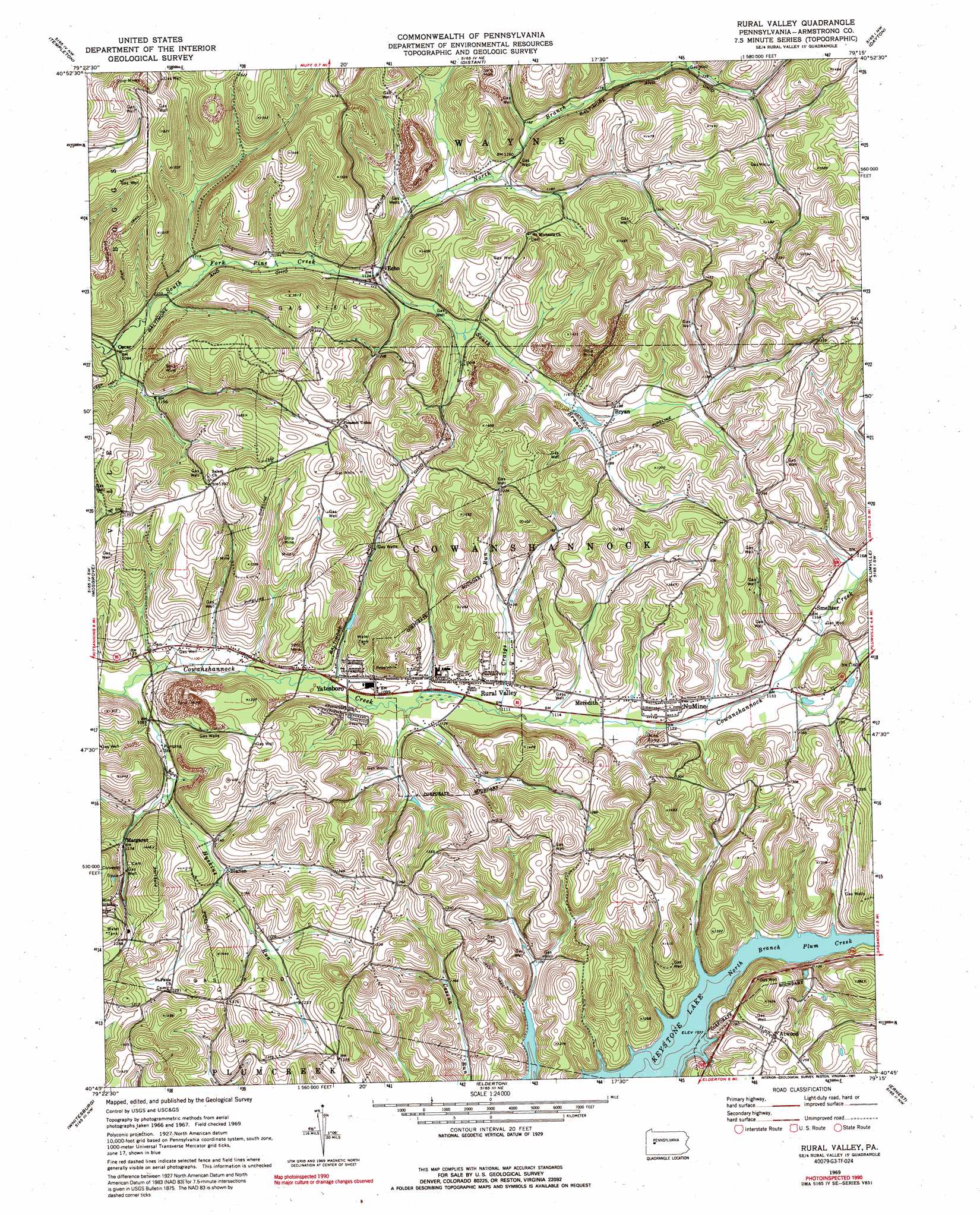
USGS Topo Quad 40079g3 - 1:24,000 scale
| Topo Map Name: | Rural Valley |
| USGS Topo Quad ID: | 40079g3 |
| Print Size: | ca. 21 1/4" wide x 27" high |
| Southeast Coordinates: | 40.75° N latitude / 79.25° W longitude |
| Map Center Coordinates: | 40.8125° N latitude / 79.3125° W longitude |
| U.S. State: | PA |
| Filename: | o40079g3.jpg |
| Download Map JPG Image: | Rural Valley topo map 1:24,000 scale |
| Map Type: | Topographic |
| Topo Series: | 7.5´ |
| Map Scale: | 1:24,000 |
| Source of Map Images: | United States Geological Survey (USGS) |
| Alternate Map Versions: |
Rural Valley PA 1969, updated 1972 Download PDF Buy paper map Rural Valley PA 1969, updated 1984 Download PDF Buy paper map Rural Valley PA 1969, updated 1991 Download PDF Buy paper map Rural Valley PA 2010 Download PDF Buy paper map Rural Valley PA 2013 Download PDF Buy paper map Rural Valley PA 2016 Download PDF Buy paper map |
1:24,000 Topo Quads surrounding Rural Valley
Rimersburg |
Sligo |
New Bethlehem |
Summerville |
Coolspring |
East Brady |
Templeton |
Distant |
Dayton |
Valier |
Kittanning |
Mosgrove |
Rural Valley |
Plumville |
Marion Center |
Leechburg |
Whitesburg |
Elderton |
Ernest |
Clymer |
Vandergrift |
Avonmore |
Mcintyre |
Indiana |
Brush Valley |
> Back to 40079e1 at 1:100,000 scale
> Back to 40078a1 at 1:250,000 scale
> Back to U.S. Topo Maps home
Rural Valley topo map: Gazetteer
Rural Valley: Populated Places
Atwood elevation 377m 1236′Blanco elevation 351m 1151′
Bryan elevation 362m 1187′
Echo elevation 343m 1125′
Margaret elevation 356m 1167′
Meredith elevation 351m 1151′
NuMine elevation 345m 1131′
Oscar elevation 331m 1085′
Rural Valley elevation 342m 1122′
Smeltzer elevation 355m 1164′
Yatesboro elevation 341m 1118′
Rural Valley: Post Offices
Echo Post Office (historical) elevation 343m 1125′Rural Valley: Streams
Craigs Run elevation 335m 1099′Huskins Run elevation 328m 1076′
North Branch South Fork Pine Creek elevation 341m 1118′
South Branch Cowanshannock Creek elevation 342m 1122′
South Branch South Fork Pine Creek elevation 341m 1118′
Rural Valley digital topo map on disk
Buy this Rural Valley topo map showing relief, roads, GPS coordinates and other geographical features, as a high-resolution digital map file on DVD:
 map DVD")