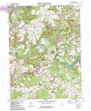
Distant Topo Map Pennsylvania
To zoom in, hover over the map of Distant
USGS Topo Quad 40079h3 - 1:24,000 scale
| Topo Map Name: | Distant |
| USGS Topo Quad ID: | 40079h3 |
| Print Size: | ca. 21 1/4" wide x 27" high |
| Southeast Coordinates: | 40.875° N latitude / 79.25° W longitude |
| Map Center Coordinates: | 40.9375° N latitude / 79.3125° W longitude |
| U.S. State: | PA |
| Filename: | o40079h3.jpg |
| Download Map JPG Image: | Distant topo map 1:24,000 scale |
| Map Type: | Topographic |
| Topo Series: | 7.5´ |
| Map Scale: | 1:24,000 |
| Source of Map Images: | United States Geological Survey (USGS) |
| Alternate Map Versions: |
Distant PA 1969, updated 1972 Download PDF Buy paper map Distant PA 1969, updated 1975 Download PDF Buy paper map Distant PA 1969, updated 1993 Download PDF Buy paper map Distant PA 2010 Download PDF Buy paper map Distant PA 2013 Download PDF Buy paper map Distant PA 2016 Download PDF Buy paper map |
1:24,000 Topo Quads surrounding Distant
> Back to 40079e1 at 1:100,000 scale
> Back to 40078a1 at 1:250,000 scale
> Back to U.S. Topo Maps home
Distant topo map: Gazetteer
Distant: Dams
Mahoning Creek Dam elevation 328m 1076′Distant: Parks
Mahoning Creek Lake Recreation Area elevation 443m 1453′State Game Lands Number 137 elevation 426m 1397′
Distant: Populated Places
Belknap elevation 455m 1492′Charlestown elevation 346m 1135′
Distant elevation 427m 1400′
Eddyville elevation 305m 1000′
Goheenville elevation 333m 1092′
Mahoning Furnace elevation 270m 885′
McCrea Furnace elevation 305m 1000′
McWilliams elevation 365m 1197′
Muff elevation 455m 1492′
Putneyville elevation 297m 974′
Seminole elevation 421m 1381′
South Bethlehem elevation 331m 1085′
Distant: Reservoirs
Mahoning Creek Lake elevation 308m 1010′Distant: Streams
Camp Run elevation 305m 1000′Cathcart Run elevation 289m 948′
Cave Run elevation 262m 859′
Glade Run elevation 328m 1076′
Hamilton Run elevation 283m 928′
Little Mudlick Creek elevation 303m 994′
Mudlick Creek elevation 353m 1158′
Pine Run elevation 302m 990′
Distant digital topo map on disk
Buy this Distant topo map showing relief, roads, GPS coordinates and other geographical features, as a high-resolution digital map file on DVD:


