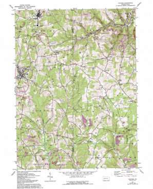
Chicora Topo Map Pennsylvania
To zoom in, hover over the map of Chicora
USGS Topo Quad 40079h6 - 1:24,000 scale
| Topo Map Name: | Chicora |
| USGS Topo Quad ID: | 40079h6 |
| Print Size: | ca. 21 1/4" wide x 27" high |
| Southeast Coordinates: | 40.875° N latitude / 79.625° W longitude |
| Map Center Coordinates: | 40.9375° N latitude / 79.6875° W longitude |
| U.S. State: | PA |
| Filename: | o40079h6.jpg |
| Download Map JPG Image: | Chicora topo map 1:24,000 scale |
| Map Type: | Topographic |
| Topo Series: | 7.5´ |
| Map Scale: | 1:24,000 |
| Source of Map Images: | United States Geological Survey (USGS) |
| Alternate Map Versions: |
Chicora PA 1964, updated 1965 Download PDF Buy paper map Chicora PA 1964, updated 1973 Download PDF Buy paper map Chicora PA 1964, updated 1993 Download PDF Buy paper map Chicora PA 2010 Download PDF Buy paper map Chicora PA 2013 Download PDF Buy paper map Chicora PA 2016 Download PDF Buy paper map |
1:24,000 Topo Quads surrounding Chicora
> Back to 40079e1 at 1:100,000 scale
> Back to 40078a1 at 1:250,000 scale
> Back to U.S. Topo Maps home
Chicora topo map: Gazetteer
Chicora: Airports
Waltman Airport elevation 420m 1377′Chicora: Bridges
Kaylor Bridge elevation 359m 1177′Chicora: Parks
State Game Lands Number 105 elevation 368m 1207′State Game Lands Number 259 elevation 389m 1276′
State Game Lands Number 304 elevation 349m 1145′
Chicora: Populated Places
Adams elevation 399m 1309′Bradys Bend elevation 285m 935′
Browns Crossroads elevation 423m 1387′
Chicora elevation 369m 1210′
Fosters Mills elevation 377m 1236′
Frogtown elevation 400m 1312′
Greenville elevation 387m 1269′
Karns City elevation 376m 1233′
Kaylor elevation 339m 1112′
Kepples Corners elevation 437m 1433′
Millerstown elevation 359m 1177′
Rattigan elevation 340m 1115′
Somerville elevation 389m 1276′
Chicora: Post Offices
Adams Post Office (historical) elevation 399m 1309′Chicora: Streams
Buffalo Run elevation 323m 1059′Cove Run elevation 295m 967′
Hart Run elevation 295m 967′
Holder Run elevation 298m 977′
Long Run elevation 342m 1122′
Pine Run elevation 322m 1056′
Chicora digital topo map on disk
Buy this Chicora topo map showing relief, roads, GPS coordinates and other geographical features, as a high-resolution digital map file on DVD:


