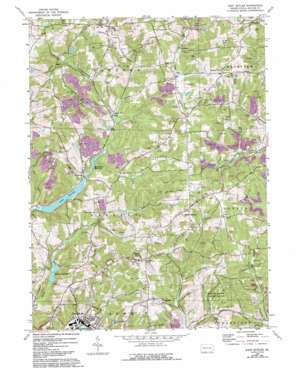
East Butler Topo Map Pennsylvania
To zoom in, hover over the map of East Butler
USGS Topo Quad 40079h7 - 1:24,000 scale
| Topo Map Name: | East Butler |
| USGS Topo Quad ID: | 40079h7 |
| Print Size: | ca. 21 1/4" wide x 27" high |
| Southeast Coordinates: | 40.875° N latitude / 79.75° W longitude |
| Map Center Coordinates: | 40.9375° N latitude / 79.8125° W longitude |
| U.S. State: | PA |
| Filename: | o40079h7.jpg |
| Download Map JPG Image: | East Butler topo map 1:24,000 scale |
| Map Type: | Topographic |
| Topo Series: | 7.5´ |
| Map Scale: | 1:24,000 |
| Source of Map Images: | United States Geological Survey (USGS) |
| Alternate Map Versions: |
East Butler PA 1964, updated 1965 Download PDF Buy paper map East Butler PA 1964, updated 1973 Download PDF Buy paper map East Butler PA 1964, updated 1973 Download PDF Buy paper map East Butler PA 1964, updated 1983 Download PDF Buy paper map East Butler PA 1964, updated 1993 Download PDF Buy paper map East Butler PA 2010 Download PDF Buy paper map East Butler PA 2013 Download PDF Buy paper map East Butler PA 2016 Download PDF Buy paper map |
1:24,000 Topo Quads surrounding East Butler
> Back to 40079e1 at 1:100,000 scale
> Back to 40078a1 at 1:250,000 scale
> Back to U.S. Topo Maps home
East Butler topo map: Gazetteer
East Butler: Dams
Boydstown Dam elevation 322m 1056′Lake Oneida Dam elevation 318m 1043′
East Butler: Parks
State Game Lands Number 164 elevation 425m 1394′East Butler: Populated Places
Boydstown elevation 326m 1069′Buena Vista elevation 420m 1377′
Byers Corner elevation 379m 1243′
East Butler elevation 324m 1062′
Greece City elevation 334m 1095′
Haysville elevation 399m 1309′
Hooker elevation 430m 1410′
Lucasville elevation 377m 1236′
North Oakland elevation 411m 1348′
Saint Joe elevation 433m 1420′
Troutman elevation 380m 1246′
Woodbine elevation 404m 1325′
East Butler: Reservoirs
Boydstown Reservoir elevation 322m 1056′Lake Oneida elevation 322m 1056′
Thorn Reservoir elevation 319m 1046′
East Butler: Streams
Pine Run elevation 314m 1030′East Butler digital topo map on disk
Buy this East Butler topo map showing relief, roads, GPS coordinates and other geographical features, as a high-resolution digital map file on DVD:


