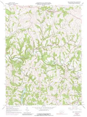
West Middletown Topo Map Pennsylvania
To zoom in, hover over the map of West Middletown
USGS Topo Quad 40080b4 - 1:24,000 scale
| Topo Map Name: | West Middletown |
| USGS Topo Quad ID: | 40080b4 |
| Print Size: | ca. 21 1/4" wide x 27" high |
| Southeast Coordinates: | 40.125° N latitude / 80.375° W longitude |
| Map Center Coordinates: | 40.1875° N latitude / 80.4375° W longitude |
| U.S. State: | PA |
| Filename: | o40080b4.jpg |
| Download Map JPG Image: | West Middletown topo map 1:24,000 scale |
| Map Type: | Topographic |
| Topo Series: | 7.5´ |
| Map Scale: | 1:24,000 |
| Source of Map Images: | United States Geological Survey (USGS) |
| Alternate Map Versions: |
West Middletown PA 1964, updated 1966 Download PDF Buy paper map West Middletown PA 1964, updated 1973 Download PDF Buy paper map West Middletown PA 1964, updated 1989 Download PDF Buy paper map West Middletown PA 2010 Download PDF Buy paper map West Middletown PA 2013 Download PDF Buy paper map West Middletown PA 2016 Download PDF Buy paper map |
1:24,000 Topo Quads surrounding West Middletown
> Back to 40080a1 at 1:100,000 scale
> Back to 40080a1 at 1:250,000 scale
> Back to U.S. Topo Maps home
West Middletown topo map: Gazetteer
West Middletown: Bridges
Noble Bridge elevation 284m 931′West Middletown: Dams
Dutch Fork Dam elevation 294m 964′Stroughton Lake Dam elevation 363m 1190′
Timber Lake Dam elevation 327m 1072′
West Middletown: Parks
Cross Creek County Park elevation 339m 1112′State Game Lands Number 232 elevation 339m 1112′
West Middletown: Populated Places
Acheson elevation 274m 898′Budaville elevation 284m 931′
Donley elevation 316m 1036′
Dunkle elevation 308m 1010′
McMillan elevation 394m 1292′
Taylorstown elevation 315m 1033′
West Middletown elevation 404m 1325′
West Middletown: Reservoirs
Dutch Fork Lake elevation 294m 964′Stroughton Lake elevation 363m 1190′
Timber Lake elevation 324m 1062′
West Middletown: Streams
Brush Run elevation 270m 885′Buck Run elevation 270m 885′
Dunkle Run elevation 277m 908′
Dutch Fork elevation 261m 856′
Hanen Run elevation 285m 935′
Indian Camp Run elevation 287m 941′
Narigan Run elevation 261m 856′
Ralston Run elevation 284m 931′
Wolf Run elevation 294m 964′
West Middletown: Valleys
Jolley Hollow elevation 300m 984′Opossum Hollow elevation 313m 1026′
Polecat Hollow elevation 290m 951′
West Middletown digital topo map on disk
Buy this West Middletown topo map showing relief, roads, GPS coordinates and other geographical features, as a high-resolution digital map file on DVD:


