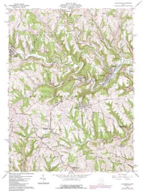
Dillonvale Topo Map Ohio
To zoom in, hover over the map of Dillonvale
USGS Topo Quad 40080b7 - 1:24,000 scale
| Topo Map Name: | Dillonvale |
| USGS Topo Quad ID: | 40080b7 |
| Print Size: | ca. 21 1/4" wide x 27" high |
| Southeast Coordinates: | 40.125° N latitude / 80.75° W longitude |
| Map Center Coordinates: | 40.1875° N latitude / 80.8125° W longitude |
| U.S. State: | OH |
| Filename: | o40080b7.jpg |
| Download Map JPG Image: | Dillonvale topo map 1:24,000 scale |
| Map Type: | Topographic |
| Topo Series: | 7.5´ |
| Map Scale: | 1:24,000 |
| Source of Map Images: | United States Geological Survey (USGS) |
| Alternate Map Versions: |
Dillonvale OH 1960, updated 1961 Download PDF Buy paper map Dillonvale OH 1960, updated 1968 Download PDF Buy paper map Dillonvale OH 1960, updated 1973 Download PDF Buy paper map Dillonvale OH 1960, updated 1978 Download PDF Buy paper map Dillonvale OH 1960, updated 1985 Download PDF Buy paper map Dillonvale OH 2010 Download PDF Buy paper map Dillonvale OH 2013 Download PDF Buy paper map Dillonvale OH 2016 Download PDF Buy paper map |
1:24,000 Topo Quads surrounding Dillonvale
> Back to 40080a1 at 1:100,000 scale
> Back to 40080a1 at 1:250,000 scale
> Back to U.S. Topo Maps home
Dillonvale topo map: Gazetteer
Dillonvale: Dams
Dorothy Mine Pond Dam elevation 281m 921′Dunglen Mine Impoundment Dam elevation 285m 935′
Dillonvale: Parks
Village of Mount Pleasant Historic District elevation 377m 1236′Dillonvale: Populated Places
Adena elevation 263m 862′Bradley elevation 369m 1210′
Colerain elevation 385m 1263′
Deyarmonville elevation 225m 738′
Dillonvale elevation 224m 734′
Dunglen elevation 237m 777′
Emerson elevation 368m 1207′
Herrick elevation 251m 823′
Long Run elevation 250m 820′
Morningview elevation 384m 1259′
Mount Pleasant elevation 378m 1240′
Olszeski Town elevation 231m 757′
Pine Valley elevation 217m 711′
Pleasant Grove elevation 362m 1187′
Ramsey elevation 295m 967′
Startle (historical) elevation 245m 803′
Dillonvale: Post Offices
Colerain Post Office elevation 390m 1279′Dillonvale Post Office elevation 222m 728′
Dunglen Post Office elevation 235m 770′
Emerson Post Office (historical) elevation 371m 1217′
Herrick Post Office (historical) elevation 250m 820′
Morning View Post Office (historical) elevation 384m 1259′
Mount Pleasant Post Office elevation 377m 1236′
Pine Valley Post Office (historical) elevation 220m 721′
Pleasant Grove Post Office (historical) elevation 355m 1164′
Ramsey Post Office (historical) elevation 307m 1007′
Startle Post Office (historical) elevation 248m 813′
Dillonvale: Reservoirs
Dorothy Mine Pond elevation 281m 921′Dunglen Mine Impoundment elevation 285m 935′
Piney Fork Prep Plant Slurry Pond elevation 336m 1102′
Dillonvale: Ridges
Blue Ridge elevation 369m 1210′Brier Ridge elevation 366m 1200′
Cherry Ridge elevation 378m 1240′
Grape Ridge elevation 367m 1204′
Grays Ridge elevation 368m 1207′
Irish Ridge elevation 372m 1220′
Scotch Ridge elevation 397m 1302′
Warren Ridge elevation 362m 1187′
Dillonvale: Streams
Cabbage Run elevation 274m 898′Coal Run elevation 290m 951′
Dry Fork elevation 219m 718′
Goose Run elevation 256m 839′
Jug Run elevation 218m 715′
Long Run elevation 235m 770′
North Fork Short Creek elevation 261m 856′
Parkers Run elevation 260m 853′
Perrin Run elevation 254m 833′
Piney Fork elevation 220m 721′
Dillonvale: Valleys
Crow Hollow elevation 248m 813′Dillonvale digital topo map on disk
Buy this Dillonvale topo map showing relief, roads, GPS coordinates and other geographical features, as a high-resolution digital map file on DVD:


