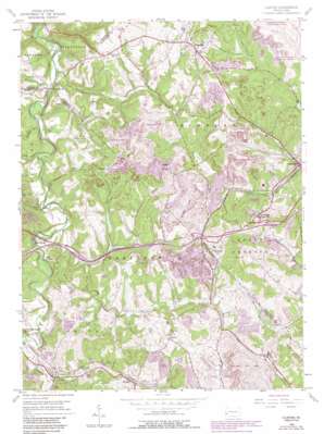
Clinton Topo Map Pennsylvania
To zoom in, hover over the map of Clinton
USGS Topo Quad 40080d3 - 1:24,000 scale
| Topo Map Name: | Clinton |
| USGS Topo Quad ID: | 40080d3 |
| Print Size: | ca. 21 1/4" wide x 27" high |
| Southeast Coordinates: | 40.375° N latitude / 80.25° W longitude |
| Map Center Coordinates: | 40.4375° N latitude / 80.3125° W longitude |
| U.S. State: | PA |
| Filename: | o40080d3.jpg |
| Download Map JPG Image: | Clinton topo map 1:24,000 scale |
| Map Type: | Topographic |
| Topo Series: | 7.5´ |
| Map Scale: | 1:24,000 |
| Source of Map Images: | United States Geological Survey (USGS) |
| Alternate Map Versions: |
Clinton PA 1954, updated 1955 Download PDF Buy paper map Clinton PA 1954, updated 1965 Download PDF Buy paper map Clinton PA 1954, updated 1969 Download PDF Buy paper map Clinton PA 1954, updated 1979 Download PDF Buy paper map Clinton PA 1954, updated 1979 Download PDF Buy paper map Clinton PA 1954, updated 1990 Download PDF Buy paper map Clinton PA 1954, updated 1990 Download PDF Buy paper map Clinton PA 1998, updated 2000 Download PDF Buy paper map Clinton PA 2010 Download PDF Buy paper map Clinton PA 2013 Download PDF Buy paper map Clinton PA 2016 Download PDF Buy paper map |
1:24,000 Topo Quads surrounding Clinton
> Back to 40080a1 at 1:100,000 scale
> Back to 40080a1 at 1:250,000 scale
> Back to U.S. Topo Maps home
Clinton topo map: Gazetteer
Clinton: Airports
Cataney Airport elevation 369m 1210′Frame Field elevation 358m 1174′
Clinton: Cliffs
Point Pleasant elevation 305m 1000′Clinton: Dams
Champion Number One Mine Refuse Bank Dam elevation 339m 1112′Champion Number One Mine Refuse Bank Dam elevation 334m 1095′
New Dam elevation 323m 1059′
Old Dam elevation 321m 1053′
Clinton: Mines
Shaw Mine elevation 355m 1164′Clinton: Parks
Hillman State Park elevation 324m 1062′State Game Lands Number 117 elevation 310m 1017′
Clinton: Populated Places
Bavington elevation 300m 984′Bulger elevation 365m 1197′
Candor elevation 348m 1141′
Champion elevation 350m 1148′
Clinton elevation 370m 1213′
Cork elevation 350m 1148′
Joffre elevation 306m 1003′
McAdams elevation 339m 1112′
Murdocksville elevation 285m 935′
Robinson elevation 359m 1177′
Santiago elevation 330m 1082′
Virsoix elevation 347m 1138′
Clinton: Post Offices
Tyre Post Office elevation 330m 1082′Clinton: Reservoirs
Sedimentation Pond Number Three elevation 334m 1095′Sludge Pond One elevation 339m 1112′
Clinton: Streams
Bigger Run elevation 265m 869′Brush Run elevation 270m 885′
Burgetts Fork elevation 296m 971′
Chamberlain Run elevation 270m 885′
Dilloe Run elevation 265m 869′
Little Raccoon Run elevation 275m 902′
North Fork Montour Run elevation 297m 974′
Potato Garden Run elevation 261m 856′
Saint Patrick Run elevation 285m 935′
South Fork Montour Run elevation 297m 974′
Wingfield Run elevation 265m 869′
Clinton digital topo map on disk
Buy this Clinton topo map showing relief, roads, GPS coordinates and other geographical features, as a high-resolution digital map file on DVD:


