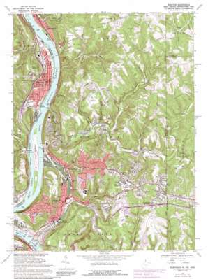
Weirton Topo Map West Virginia
To zoom in, hover over the map of Weirton
USGS Topo Quad 40080d5 - 1:24,000 scale
| Topo Map Name: | Weirton |
| USGS Topo Quad ID: | 40080d5 |
| Print Size: | ca. 21 1/4" wide x 27" high |
| Southeast Coordinates: | 40.375° N latitude / 80.5° W longitude |
| Map Center Coordinates: | 40.4375° N latitude / 80.5625° W longitude |
| U.S. States: | WV, OH, PA |
| Filename: | o40080d5.jpg |
| Download Map JPG Image: | Weirton topo map 1:24,000 scale |
| Map Type: | Topographic |
| Topo Series: | 7.5´ |
| Map Scale: | 1:24,000 |
| Source of Map Images: | United States Geological Survey (USGS) |
| Alternate Map Versions: |
Weirton WV 1958, updated 1960 Download PDF Buy paper map Weirton WV 1958, updated 1965 Download PDF Buy paper map Weirton WV 1968, updated 1970 Download PDF Buy paper map Weirton WV 1968, updated 1978 Download PDF Buy paper map Weirton WV 1968, updated 1990 Download PDF Buy paper map Weirton WV 1994, updated 1998 Download PDF Buy paper map Weirton WV 2010 Download PDF Buy paper map Weirton WV 2014 Download PDF Buy paper map Weirton WV 2016 Download PDF Buy paper map |
1:24,000 Topo Quads surrounding Weirton
> Back to 40080a1 at 1:100,000 scale
> Back to 40080a1 at 1:250,000 scale
> Back to U.S. Topo Maps home
Weirton topo map: Gazetteer
Weirton: Airports
Weirton - Steubenville Seaplane Base elevation 198m 649′Weirton: Bars
Croxton Bar elevation 200m 656′Weirton: Bridges
Fort Steuben Bridge elevation 198m 649′Veterans Memorial Bridge elevation 198m 649′
Weirton: Dams
Harmon Creek Structure Number 14 Dam elevation 269m 882′Harmon Creek Structure Number One Dam elevation 268m 879′
Weirton: Islands
Browns Island elevation 207m 679′Griffen Island elevation 199m 652′
Weirton: Parks
Kaul Wildlife Area elevation 219m 718′Margaret M Weir Park elevation 304m 997′
Memorial Park elevation 234m 767′
Vaccaro Baseball Field elevation 309m 1013′
Weirton: Populated Places
Blackhorse (historical) elevation 224m 734′Braithewaite (historical) elevation 218m 715′
Calumet elevation 212m 695′
Chelsea elevation 221m 725′
Chestnut Hill elevation 361m 1184′
Costonia elevation 218m 715′
Fairview Heights elevation 361m 1184′
Holidays Cove elevation 214m 702′
Kings Creek elevation 211m 692′
Logrow elevation 245m 803′
Markle elevation 225m 738′
Marland Heights elevation 330m 1082′
New Cumberland elevation 220m 721′
Paris elevation 374m 1227′
Pleasant Valley elevation 241m 790′
Sun Valley elevation 269m 882′
Toronto elevation 214m 702′
Vermont Terrace elevation 354m 1161′
Weircrest elevation 304m 997′
Weirton elevation 230m 754′
Weirton Heights elevation 365m 1197′
Weirton Junction elevation 210m 688′
Zalia elevation 210m 688′
Weirton: Post Offices
Calumet Post Office (historical) elevation 212m 695′Costonia Post Office (historical) elevation 220m 721′
Hollidays Cove Post Office elevation 214m 702′
New Cumberland Post Office elevation 221m 725′
Toronto Post Office elevation 213m 698′
Weirton Post Office elevation 233m 764′
Weirton: Reservoirs
Hughes Lake elevation 306m 1003′Weirton: Ridges
McKim Ridge elevation 332m 1089′Weirton: Streams
Alexanders Run elevation 236m 774′Croxton Run elevation 200m 656′
Harmon Creek elevation 200m 656′
Harmon Creek elevation 200m 656′
Holbert Run elevation 200m 656′
Island Creek elevation 199m 652′
Jeddo Run elevation 198m 649′
Kings Creek elevation 205m 672′
Kings Creek elevation 204m 669′
Lawrence Run elevation 306m 1003′
Lick Run elevation 240m 787′
Little Island Creek elevation 200m 656′
Marrow Run elevation 230m 754′
North Fork Kings Creek elevation 226m 741′
North Fork Kings Creek elevation 226m 741′
Righthand Fork Croxton Run elevation 242m 793′
Rush Run elevation 225m 738′
Sappingtons Run elevation 221m 725′
Turkeyfoot Run elevation 223m 731′
Weirton: Summits
Myers Knob elevation 363m 1190′Taylors Hill elevation 340m 1115′
Weirton: Valleys
Wildcat Hollow elevation 223m 731′Weirton digital topo map on disk
Buy this Weirton topo map showing relief, roads, GPS coordinates and other geographical features, as a high-resolution digital map file on DVD:


