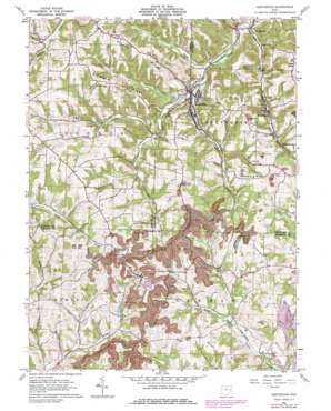
Amsterdam Topo Map Ohio
To zoom in, hover over the map of Amsterdam
USGS Topo Quad 40080d8 - 1:24,000 scale
| Topo Map Name: | Amsterdam |
| USGS Topo Quad ID: | 40080d8 |
| Print Size: | ca. 21 1/4" wide x 27" high |
| Southeast Coordinates: | 40.375° N latitude / 80.875° W longitude |
| Map Center Coordinates: | 40.4375° N latitude / 80.9375° W longitude |
| U.S. State: | OH |
| Filename: | o40080d8.jpg |
| Download Map JPG Image: | Amsterdam topo map 1:24,000 scale |
| Map Type: | Topographic |
| Topo Series: | 7.5´ |
| Map Scale: | 1:24,000 |
| Source of Map Images: | United States Geological Survey (USGS) |
| Alternate Map Versions: |
Amsterdam OH 1960, updated 1962 Download PDF Buy paper map Amsterdam OH 1960, updated 1973 Download PDF Buy paper map Amsterdam OH 1960, updated 1978 Download PDF Buy paper map Amsterdam OH 2010 Download PDF Buy paper map Amsterdam OH 2013 Download PDF Buy paper map Amsterdam OH 2016 Download PDF Buy paper map |
1:24,000 Topo Quads surrounding Amsterdam
> Back to 40080a1 at 1:100,000 scale
> Back to 40080a1 at 1:250,000 scale
> Back to U.S. Topo Maps home
Amsterdam topo map: Gazetteer
Amsterdam: Dams
Fay Dam elevation 344m 1128′Amsterdam: Populated Places
Amsterdam elevation 285m 935′Apex elevation 352m 1154′
Circle Green elevation 408m 1338′
Germano elevation 402m 1318′
Middleburg elevation 344m 1128′
Swanson elevation 316m 1036′
The Eastern elevation 285m 935′
Wolf Run elevation 308m 1010′
Amsterdam: Post Offices
Amsterdam Post Office elevation 286m 938′Circle Green Post Office (historical) elevation 403m 1322′
Germano Post Office (historical) elevation 402m 1318′
Wolf Run Post Office elevation 310m 1017′
Amsterdam: Reservoirs
Fay Lake elevation 344m 1128′Indian Lake elevation 385m 1263′
Amsterdam: Ridges
Blue Ridge elevation 384m 1259′Pigeon Ridge elevation 391m 1282′
Red Dog Ridge elevation 381m 1250′
Simmons Ridge elevation 377m 1236′
Amsterdam: Streams
Cox Creek elevation 283m 928′Elk Fork elevation 292m 958′
Elk Lick elevation 292m 958′
Gault Creek elevation 310m 1017′
Goose Creek elevation 288m 944′
Wolf Run elevation 274m 898′
Amsterdam digital topo map on disk
Buy this Amsterdam topo map showing relief, roads, GPS coordinates and other geographical features, as a high-resolution digital map file on DVD:


