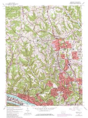
Emsworth Topo Map Pennsylvania
To zoom in, hover over the map of Emsworth
USGS Topo Quad 40080e1 - 1:24,000 scale
| Topo Map Name: | Emsworth |
| USGS Topo Quad ID: | 40080e1 |
| Print Size: | ca. 21 1/4" wide x 27" high |
| Southeast Coordinates: | 40.5° N latitude / 80° W longitude |
| Map Center Coordinates: | 40.5625° N latitude / 80.0625° W longitude |
| U.S. State: | PA |
| Filename: | o40080e1.jpg |
| Download Map JPG Image: | Emsworth topo map 1:24,000 scale |
| Map Type: | Topographic |
| Topo Series: | 7.5´ |
| Map Scale: | 1:24,000 |
| Source of Map Images: | United States Geological Survey (USGS) |
| Alternate Map Versions: |
Emsworth PA 1953, updated 1955 Download PDF Buy paper map Emsworth PA 1960, updated 1961 Download PDF Buy paper map Emsworth PA 1960, updated 1968 Download PDF Buy paper map Emsworth PA 1960, updated 1971 Download PDF Buy paper map Emsworth PA 1960, updated 1980 Download PDF Buy paper map Emsworth PA 1960, updated 1980 Download PDF Buy paper map Emsworth PA 1993, updated 1999 Download PDF Buy paper map Emsworth PA 2010 Download PDF Buy paper map Emsworth PA 2013 Download PDF Buy paper map Emsworth PA 2016 Download PDF Buy paper map |
1:24,000 Topo Quads surrounding Emsworth
> Back to 40080e1 at 1:100,000 scale
> Back to 40080a1 at 1:250,000 scale
> Back to U.S. Topo Maps home
Emsworth topo map: Gazetteer
Emsworth: Bends
Whites Ripple elevation 308m 1010′Emsworth: Channels
Back Channel elevation 211m 692′The Trap elevation 308m 1010′
Emsworth: Crossings
Interchange 12 elevation 360m 1181′Interchange 14 elevation 320m 1049′
Interchange 15 elevation 261m 856′
Interchange 20 elevation 359m 1177′
Interchange 68 elevation 297m 974′
Interchange 72 elevation 362m 1187′
Interchange 73 elevation 379m 1243′
Emsworth: Dams
Emsworth Back Channel Dam elevation 216m 708′Emsworth Dam elevation 211m 692′
Emsworth Locks and Dams elevation 219m 718′
Emsworth: Islands
Marshall Island elevation 302m 990′Neville Island elevation 219m 718′
Emsworth: Lakes
Park Lake elevation 320m 1049′Emsworth: Parks
Bellevue Memorial Park elevation 332m 1089′North Park elevation 349m 1145′
Tree of Life Memorial Park elevation 368m 1207′
West View Park elevation 325m 1066′
Emsworth: Populated Places
Avalon elevation 285m 935′Ben Avon elevation 255m 836′
Ben Avon Heights elevation 352m 1154′
Berkeley Hills elevation 346m 1135′
Dixmont elevation 254m 833′
Emsworth elevation 223m 731′
Fox Ridge elevation 352m 1154′
Franklin Park elevation 375m 1230′
Highcliff elevation 374m 1227′
Highland elevation 365m 1197′
Ingomar elevation 368m 1207′
Keown elevation 311m 1020′
Keown Station elevation 327m 1072′
Laurel Gardens elevation 352m 1154′
McKnight elevation 357m 1171′
Mount Nebo elevation 370m 1213′
Perrysville elevation 349m 1145′
Stonedale elevation 278m 912′
West View elevation 345m 1131′
Emsworth: Post Offices
McKnight Post Office elevation 308m 1010′West View Post Office elevation 325m 1066′
Wexford Post Office elevation 391m 1282′
Emsworth: Reservoirs
Emsworth Pool elevation 219m 718′Marshall Lake elevation 302m 990′
Sechlers Lake elevation 304m 997′
Emsworth: Streams
Bear Run elevation 255m 836′Fish Run elevation 315m 1033′
Harts Run elevation 272m 892′
Lowries Run elevation 211m 692′
McKnight Run elevation 279m 915′
North Fork Pine Creek elevation 293m 961′
Rinaman Run elevation 305m 1000′
Spruce Run elevation 216m 708′
Toms Run elevation 211m 692′
Wexford Run elevation 308m 1010′
Emsworth digital topo map on disk
Buy this Emsworth topo map showing relief, roads, GPS coordinates and other geographical features, as a high-resolution digital map file on DVD:


