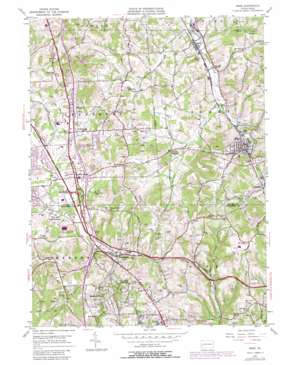
Mars Topo Map Pennsylvania
To zoom in, hover over the map of Mars
USGS Topo Quad 40080f1 - 1:24,000 scale
| Topo Map Name: | Mars |
| USGS Topo Quad ID: | 40080f1 |
| Print Size: | ca. 21 1/4" wide x 27" high |
| Southeast Coordinates: | 40.625° N latitude / 80° W longitude |
| Map Center Coordinates: | 40.6875° N latitude / 80.0625° W longitude |
| U.S. State: | PA |
| Filename: | o40080f1.jpg |
| Download Map JPG Image: | Mars topo map 1:24,000 scale |
| Map Type: | Topographic |
| Topo Series: | 7.5´ |
| Map Scale: | 1:24,000 |
| Source of Map Images: | United States Geological Survey (USGS) |
| Alternate Map Versions: |
Mars PA 1953, updated 1955 Download PDF Buy paper map Mars PA 1953, updated 1963 Download PDF Buy paper map Mars PA 1953, updated 1970 Download PDF Buy paper map Mars PA 1953, updated 1980 Download PDF Buy paper map Mars PA 1953, updated 1980 Download PDF Buy paper map Mars PA 2010 Download PDF Buy paper map Mars PA 2013 Download PDF Buy paper map Mars PA 2016 Download PDF Buy paper map |
1:24,000 Topo Quads surrounding Mars
> Back to 40080e1 at 1:100,000 scale
> Back to 40080a1 at 1:250,000 scale
> Back to U.S. Topo Maps home
Mars topo map: Gazetteer
Mars: Airports
Lakehill Airport elevation 313m 1026′Mars: Crossings
Interchange 28 elevation 317m 1040′Interchange 75 elevation 342m 1122′
Interchange 76 elevation 338m 1108′
Interchange 78 elevation 333m 1092′
Perry Highway Interchange elevation 317m 1040′
Mars: Dams
Treesdale Farm Dam elevation 353m 1158′Mars: Parks
State Game Lands Number 203 elevation 341m 1118′Mars: Populated Places
Bradford Woods elevation 367m 1204′Callery elevation 292m 958′
Criders Corners elevation 334m 1095′
Downieville elevation 325m 1066′
Fox Run elevation 330m 1082′
Glen Eden elevation 355m 1164′
Hendersonville elevation 371m 1217′
Mars elevation 317m 1040′
Myoma elevation 316m 1036′
Ogle elevation 321m 1053′
Seven Fields elevation 337m 1105′
Thielman Crossroads elevation 336m 1102′
Warrendale elevation 320m 1049′
Wexford elevation 367m 1204′
Mars: Post Offices
Bradford Woods Post Office elevation 371m 1217′Callery Post Office elevation 297m 974′
Cranberry Township Post Office elevation 316m 1036′
Mars Post Office elevation 322m 1056′
Mars: Reservoirs
Treesdale Farm Reservoir elevation 353m 1158′Mars: Streams
Kaufman Run elevation 365m 1197′Wolfe Run elevation 293m 961′
Mars digital topo map on disk
Buy this Mars topo map showing relief, roads, GPS coordinates and other geographical features, as a high-resolution digital map file on DVD:


