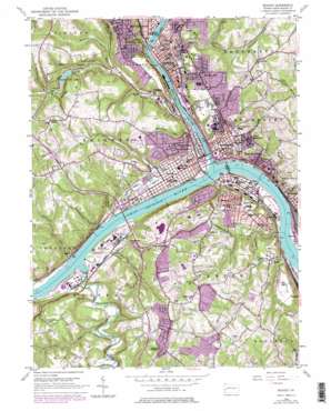
Beaver Topo Map Pennsylvania
To zoom in, hover over the map of Beaver
USGS Topo Quad 40080f3 - 1:24,000 scale
| Topo Map Name: | Beaver |
| USGS Topo Quad ID: | 40080f3 |
| Print Size: | ca. 21 1/4" wide x 27" high |
| Southeast Coordinates: | 40.625° N latitude / 80.25° W longitude |
| Map Center Coordinates: | 40.6875° N latitude / 80.3125° W longitude |
| U.S. State: | PA |
| Filename: | o40080f3.jpg |
| Download Map JPG Image: | Beaver topo map 1:24,000 scale |
| Map Type: | Topographic |
| Topo Series: | 7.5´ |
| Map Scale: | 1:24,000 |
| Source of Map Images: | United States Geological Survey (USGS) |
| Alternate Map Versions: |
Beaver PA 1953, updated 1955 Download PDF Buy paper map Beaver PA 1953, updated 1966 Download PDF Buy paper map Beaver PA 1953, updated 1969 Download PDF Buy paper map Beaver PA 1953, updated 1979 Download PDF Buy paper map Beaver PA 2010 Download PDF Buy paper map Beaver PA 2013 Download PDF Buy paper map Beaver PA 2016 Download PDF Buy paper map |
1:24,000 Topo Quads surrounding Beaver
> Back to 40080e1 at 1:100,000 scale
> Back to 40080a1 at 1:250,000 scale
> Back to U.S. Topo Maps home
Beaver topo map: Gazetteer
Beaver: Airports
Black Rock Airport elevation 334m 1095′Beaver: Bars
Lacock Bar elevation 226m 741′Beaver: Bridges
Monaca Rochester Bridge elevation 208m 682′Tenth Street Bridge elevation 213m 698′
Beaver: Dams
Brady Dam elevation 250m 820′Beaver: Parks
Brady Run Park elevation 253m 830′Beaver: Populated Places
Beaver elevation 241m 790′Bellowsville elevation 244m 800′
Bridgewater elevation 243m 797′
Doctor Heights elevation 300m 984′
East Rochester elevation 262m 859′
Fallston elevation 304m 997′
Freedom elevation 238m 780′
Josephtown elevation 244m 800′
Kenwood elevation 333m 1092′
Marion Hill elevation 282m 925′
McDonaldtown elevation 233m 764′
Merrill elevation 215m 705′
Monaca elevation 225m 738′
New Brighton elevation 225m 738′
North Rochester elevation 280m 918′
Patterson Heights elevation 325m 1066′
Phillipsburg elevation 221m 725′
Pulaski elevation 328m 1076′
Rochester elevation 243m 797′
Saint Clair elevation 248m 813′
Stobo elevation 288m 944′
Vanport elevation 229m 751′
Beaver: Post Offices
Freedom Post Office elevation 223m 731′Monaca Post Office elevation 225m 738′
Rochester Post Office elevation 237m 777′
West Bridgewater Post Office elevation 308m 1010′
Beaver: Reservoirs
Bradys Run Lake elevation 250m 820′Beaver: Springs
Lacock Spring elevation 245m 803′Beaver: Streams
Beaver River elevation 208m 682′Blockhouse Run elevation 209m 685′
Brady Run elevation 209m 685′
Crows Run elevation 210m 688′
Dutchman Run elevation 213m 698′
Elkhorn Run elevation 230m 754′
Fishpot Run elevation 214m 702′
Fosburg Run elevation 230m 754′
Fourmile Run elevation 208m 682′
Hamilton Run elevation 223m 731′
Lacock Run elevation 208m 682′
McKinley Run elevation 209m 685′
Moon Run elevation 208m 682′
North Branch Brady Run elevation 247m 810′
Poorhouse Run elevation 212m 695′
Raccoon Creek elevation 208m 682′
Rag Run elevation 213m 698′
Shafers Run elevation 292m 958′
South Branch Brady Run elevation 238m 780′
Twomile Run elevation 208m 682′
Beaver: Summits
Bunker Hill elevation 375m 1230′Beaver digital topo map on disk
Buy this Beaver topo map showing relief, roads, GPS coordinates and other geographical features, as a high-resolution digital map file on DVD:


