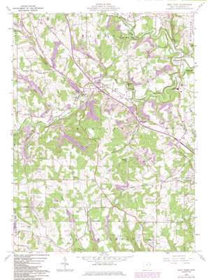
West Point Topo Map Ohio
To zoom in, hover over the map of West Point
USGS Topo Quad 40080f6 - 1:24,000 scale
| Topo Map Name: | West Point |
| USGS Topo Quad ID: | 40080f6 |
| Print Size: | ca. 21 1/4" wide x 27" high |
| Southeast Coordinates: | 40.625° N latitude / 80.625° W longitude |
| Map Center Coordinates: | 40.6875° N latitude / 80.6875° W longitude |
| U.S. State: | OH |
| Filename: | o40080f6.jpg |
| Download Map JPG Image: | West Point topo map 1:24,000 scale |
| Map Type: | Topographic |
| Topo Series: | 7.5´ |
| Map Scale: | 1:24,000 |
| Source of Map Images: | United States Geological Survey (USGS) |
| Alternate Map Versions: |
West Point OH 1960, updated 1962 Download PDF Buy paper map West Point OH 1960, updated 1966 Download PDF Buy paper map West Point OH 1960, updated 1972 Download PDF Buy paper map West Point OH 1960, updated 1981 Download PDF Buy paper map West Point OH 1960, updated 1985 Download PDF Buy paper map West Point OH 2010 Download PDF Buy paper map West Point OH 2013 Download PDF Buy paper map West Point OH 2016 Download PDF Buy paper map |
1:24,000 Topo Quads surrounding West Point
> Back to 40080e1 at 1:100,000 scale
> Back to 40080a1 at 1:250,000 scale
> Back to U.S. Topo Maps home
West Point topo map: Gazetteer
West Point: Airports
Columbiana County Airport elevation 351m 1151′Johnston Airport elevation 367m 1204′
West Point: Dams
Bibbees Little Rock Lake Dam elevation 323m 1059′Bogart Pond Dam elevation 336m 1102′
Highlandtown Lake Dam elevation 319m 1046′
Lake Cha-Vel Dam elevation 349m 1145′
Lake Samary Dam elevation 306m 1003′
West Point: Forests
Beaver Creek State Forest elevation 305m 1000′West Point: Lakes
Chettle Lake elevation 319m 1046′West Point: Populated Places
Campus elevation 300m 984′Glasgow elevation 380m 1246′
Glenmoor Trailer Park elevation 333m 1092′
Hillcrest elevation 316m 1036′
Kam Trailer Park elevation 300m 984′
Middle Beaver (historical) elevation 259m 849′
Rock Camp elevation 311m 1020′
Sunrise Mobile Home Park elevation 336m 1102′
Twin Oaks Trailer Park elevation 332m 1089′
West Point elevation 283m 928′
Williamsport elevation 257m 843′
West Point: Post Offices
Campus Post Office (historical) elevation 298m 977′Glasgow Post Office (historical) elevation 380m 1246′
Rock Camp Post Office (historical) elevation 307m 1007′
West Point Post Office elevation 282m 925′
Westpoint Post Office (historical) elevation 282m 925′
West Point: Reservoirs
Bibbees Little Rock Lake elevation 323m 1059′Bogart Pond elevation 336m 1102′
Highlandtown Reservoir elevation 319m 1046′
Lake Cha-Vel elevation 349m 1145′
Lake Samary elevation 306m 1003′
West Point: Streams
Alder Lick Run elevation 304m 997′Brush Run elevation 278m 912′
McCormick Run elevation 283m 928′
Middle Fork Little Beaver Creek elevation 296m 971′
Patterson Creek elevation 274m 898′
Peters Run elevation 279m 915′
Pine Run elevation 265m 869′
Turkeyfoot Run elevation 259m 849′
West Fork Little Beaver Creek elevation 295m 967′
West Point: Summits
Round Knob elevation 433m 1420′West Point: Trails
Pine Ridge Trail elevation 355m 1164′West Point digital topo map on disk
Buy this West Point topo map showing relief, roads, GPS coordinates and other geographical features, as a high-resolution digital map file on DVD:


