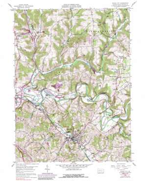
Evans City Topo Map Pennsylvania
To zoom in, hover over the map of Evans City
USGS Topo Quad 40080g1 - 1:24,000 scale
| Topo Map Name: | Evans City |
| USGS Topo Quad ID: | 40080g1 |
| Print Size: | ca. 21 1/4" wide x 27" high |
| Southeast Coordinates: | 40.75° N latitude / 80° W longitude |
| Map Center Coordinates: | 40.8125° N latitude / 80.0625° W longitude |
| U.S. State: | PA |
| Filename: | o40080g1.jpg |
| Download Map JPG Image: | Evans City topo map 1:24,000 scale |
| Map Type: | Topographic |
| Topo Series: | 7.5´ |
| Map Scale: | 1:24,000 |
| Source of Map Images: | United States Geological Survey (USGS) |
| Alternate Map Versions: |
Evans City PA 1958, updated 1959 Download PDF Buy paper map Evans City PA 1958, updated 1971 Download PDF Buy paper map Evans City PA 1958, updated 1983 Download PDF Buy paper map Evans City PA 1958, updated 1989 Download PDF Buy paper map Evans City PA 1958, updated 1989 Download PDF Buy paper map Evans City PA 2010 Download PDF Buy paper map Evans City PA 2013 Download PDF Buy paper map Evans City PA 2016 Download PDF Buy paper map |
1:24,000 Topo Quads surrounding Evans City
> Back to 40080e1 at 1:100,000 scale
> Back to 40080a1 at 1:250,000 scale
> Back to U.S. Topo Maps home
Evans City topo map: Gazetteer
Evans City: Airports
Brennan Airport elevation 401m 1315′Pabst Blue Ribbon Airport elevation 355m 1164′
Evans City: Dams
Evansburg Dam Number Two elevation 291m 954′Supply Dam elevation 317m 1040′
Evans City: Populated Places
Buhls Station elevation 291m 954′Connoquenessing elevation 396m 1299′
Eidenau elevation 290m 951′
Evans City elevation 283m 928′
Harmony Junction elevation 273m 895′
Middle Lancaster elevation 401m 1315′
Petersville elevation 389m 1276′
Wahlville elevation 283m 928′
Watters elevation 319m 1046′
Zeno elevation 306m 1003′
Evans City: Post Offices
Carr Post Office (historical) elevation 316m 1036′Connoquenessing Post Office elevation 396m 1299′
Eldenau Post Office (historical) elevation 284m 931′
Evans City Post Office elevation 284m 931′
Evans City: Reservoirs
Evansburg Reservoir elevation 317m 1040′Evansburg Reservoir Number Two elevation 291m 954′
Evans City: Streams
Breakneck Creek elevation 272m 892′Crab Run elevation 291m 954′
Glade Run elevation 291m 954′
Likens Run elevation 280m 918′
Little Connoquenessing Creek elevation 274m 898′
Little Yellow Creek elevation 297m 974′
Mulligan Run elevation 313m 1026′
Semiconon Run elevation 303m 994′
Yellow Creek elevation 288m 944′
Evans City digital topo map on disk
Buy this Evans City topo map showing relief, roads, GPS coordinates and other geographical features, as a high-resolution digital map file on DVD:


