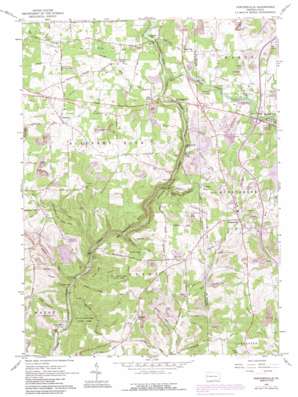
Portersville Topo Map Pennsylvania
To zoom in, hover over the map of Portersville
USGS Topo Quad 40080h2 - 1:24,000 scale
| Topo Map Name: | Portersville |
| USGS Topo Quad ID: | 40080h2 |
| Print Size: | ca. 21 1/4" wide x 27" high |
| Southeast Coordinates: | 40.875° N latitude / 80.125° W longitude |
| Map Center Coordinates: | 40.9375° N latitude / 80.1875° W longitude |
| U.S. State: | PA |
| Filename: | o40080h2.jpg |
| Download Map JPG Image: | Portersville topo map 1:24,000 scale |
| Map Type: | Topographic |
| Topo Series: | 7.5´ |
| Map Scale: | 1:24,000 |
| Source of Map Images: | United States Geological Survey (USGS) |
| Alternate Map Versions: |
Portersville PA 1961, updated 1964 Download PDF Buy paper map Portersville PA 1961, updated 1972 Download PDF Buy paper map Portersville PA 1961, updated 1979 Download PDF Buy paper map Portersville PA 1961, updated 1990 Download PDF Buy paper map Portersville PA 2010 Download PDF Buy paper map Portersville PA 2013 Download PDF Buy paper map Portersville PA 2016 Download PDF Buy paper map |
1:24,000 Topo Quads surrounding Portersville
> Back to 40080e1 at 1:100,000 scale
> Back to 40080a1 at 1:250,000 scale
> Back to U.S. Topo Maps home
Portersville topo map: Gazetteer
Portersville: Airports
Kottraba Airport elevation 383m 1256′Pisor Landing Area elevation 379m 1243′
Portersville: Bridges
Armstrong Bridge elevation 272m 892′Breakneck Bridge elevation 345m 1131′
Eckert Bridge elevation 310m 1017′
Harris Bridge elevation 277m 908′
Kildoo Bridge elevation 358m 1174′
Portersville: Falls
Grant City Falls elevation 350m 1148′Spillway Falls elevation 347m 1138′
Portersville: Lakes
Coopers Lake elevation 356m 1167′Perry Lake elevation 377m 1236′
Portersville: Parks
McConnells Mill State Park elevation 349m 1145′Moraine State Park elevation 382m 1253′
Portersville: Populated Places
Gibsondale elevation 336m 1102′Grant City elevation 387m 1269′
Kennedy Mill elevation 335m 1099′
McConnells Mill elevation 330m 1082′
Pleasant Hill elevation 389m 1276′
Portersville elevation 415m 1361′
Princeton elevation 406m 1332′
Rose Point elevation 337m 1105′
Shawwood Park elevation 364m 1194′
Portersville: Streams
Brush Run elevation 321m 1053′Cheeseman Run elevation 302m 990′
Grindstone Run elevation 293m 961′
Hell Run elevation 273m 895′
Muddy Creek elevation 327m 1072′
Skunk Run elevation 265m 869′
Portersville: Valleys
Slippery Rock Creek Gorge elevation 275m 902′Portersville digital topo map on disk
Buy this Portersville topo map showing relief, roads, GPS coordinates and other geographical features, as a high-resolution digital map file on DVD:


