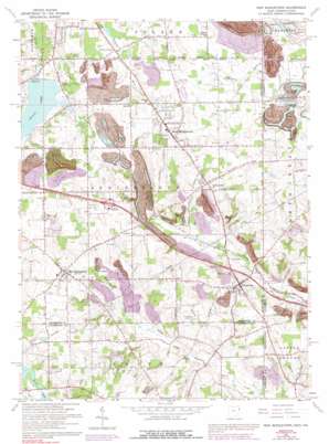
New Middletown Topo Map Ohio
To zoom in, hover over the map of New Middletown
USGS Topo Quad 40080h5 - 1:24,000 scale
| Topo Map Name: | New Middletown |
| USGS Topo Quad ID: | 40080h5 |
| Print Size: | ca. 21 1/4" wide x 27" high |
| Southeast Coordinates: | 40.875° N latitude / 80.5° W longitude |
| Map Center Coordinates: | 40.9375° N latitude / 80.5625° W longitude |
| U.S. States: | OH, PA |
| Filename: | o40080h5.jpg |
| Download Map JPG Image: | New Middletown topo map 1:24,000 scale |
| Map Type: | Topographic |
| Topo Series: | 7.5´ |
| Map Scale: | 1:24,000 |
| Source of Map Images: | United States Geological Survey (USGS) |
| Alternate Map Versions: |
New Middletown OH 1951, updated 1953 Download PDF Buy paper map New Middletown OH 1963, updated 1964 Download PDF Buy paper map New Middletown OH 1963, updated 1978 Download PDF Buy paper map New Middletown OH 1963, updated 1992 Download PDF Buy paper map New Middletown OH 2011 Download PDF Buy paper map New Middletown OH 2013 Download PDF Buy paper map New Middletown OH 2016 Download PDF Buy paper map |
1:24,000 Topo Quads surrounding New Middletown
> Back to 40080e1 at 1:100,000 scale
> Back to 40080a1 at 1:250,000 scale
> Back to U.S. Topo Maps home
New Middletown topo map: Gazetteer
New Middletown: Airports
Morris Airport elevation 375m 1230′Petersburg Airport elevation 349m 1145′
Richey Airport elevation 361m 1184′
New Middletown: Dams
Collier Lake Dam elevation 338m 1108′Evans Lake Dam elevation 319m 1046′
Go-Tag-A-Long Lake Dam elevation 343m 1125′
Pa-21 Dam elevation 343m 1125′
New Middletown: Populated Places
Deer Meadow Mobile Home Park elevation 367m 1204′Ginger Hill elevation 363m 1190′
J And H Mobile Home Park elevation 344m 1128′
Meadowood elevation 371m 1217′
New Middletown elevation 382m 1253′
New Springfield elevation 369m 1210′
Petersburg elevation 344m 1128′
Smith Corners elevation 340m 1115′
Subrosa (historical) elevation 372m 1220′
New Middletown: Post Offices
New Middletown Post Office elevation 381m 1250′Subrosa Post Office (historical) elevation 370m 1213′
New Middletown: Reservoirs
Collier Lake elevation 338m 1108′Evans Lake elevation 319m 1046′
Go-Tag-Along Lake elevation 343m 1125′
New Middletown: Streams
Harman Run elevation 322m 1056′Honey Creek elevation 318m 1043′
New Middletown digital topo map on disk
Buy this New Middletown topo map showing relief, roads, GPS coordinates and other geographical features, as a high-resolution digital map file on DVD:


