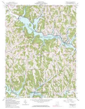
Deersville Topo Map Ohio
To zoom in, hover over the map of Deersville
USGS Topo Quad 40081c2 - 1:24,000 scale
| Topo Map Name: | Deersville |
| USGS Topo Quad ID: | 40081c2 |
| Print Size: | ca. 21 1/4" wide x 27" high |
| Southeast Coordinates: | 40.25° N latitude / 81.125° W longitude |
| Map Center Coordinates: | 40.3125° N latitude / 81.1875° W longitude |
| U.S. State: | OH |
| Filename: | o40081c2.jpg |
| Download Map JPG Image: | Deersville topo map 1:24,000 scale |
| Map Type: | Topographic |
| Topo Series: | 7.5´ |
| Map Scale: | 1:24,000 |
| Source of Map Images: | United States Geological Survey (USGS) |
| Alternate Map Versions: |
Deersville OH 1961, updated 1963 Download PDF Buy paper map Deersville OH 1961, updated 1973 Download PDF Buy paper map Deersville OH 1961, updated 1984 Download PDF Buy paper map Deersville OH 1961, updated 1984 Download PDF Buy paper map Deersville OH 1994, updated 1998 Download PDF Buy paper map Deersville OH 2010 Download PDF Buy paper map Deersville OH 2013 Download PDF Buy paper map Deersville OH 2016 Download PDF Buy paper map |
1:24,000 Topo Quads surrounding Deersville
> Back to 40081a1 at 1:100,000 scale
> Back to 40080a1 at 1:250,000 scale
> Back to U.S. Topo Maps home
Deersville topo map: Gazetteer
Deersville: Bays
Beall Bay elevation 270m 885′Beaverdam Run Bay elevation 271m 889′
Bontrager Bay elevation 269m 882′
Brushy Fork Bay elevation 268m 879′
Clear Fork Bay elevation 269m 882′
Colman Run Bay elevation 270m 885′
Deersville Bay elevation 270m 885′
Edgington Run Bay elevation 269m 882′
Little Colman Bay elevation 269m 882′
Lower Beaverdam Bay elevation 266m 872′
Mathews Bay elevation 269m 882′
Willis Run Bay elevation 266m 872′
Wye Bay elevation 267m 875′
Deersville: Capes
Long Point elevation 284m 931′Deersville: Dams
Tappan Dam elevation 272m 892′Van Horn Pond Dam elevation 305m 1000′
Deersville: Parks
Tappan Lake Park elevation 314m 1030′Deersville: Populated Places
Clendening (historical) elevation 329m 1079′Deersville elevation 376m 1233′
East Shore Cottage Area elevation 276m 905′
Hattonia (historical) elevation 367m 1204′
Laceyville (historical) elevation 274m 898′
Pleasant Valley (historical) elevation 278m 912′
Smithdale (historical) elevation 276m 905′
Tappan elevation 304m 997′
West Shore Cottage Area elevation 287m 941′
Deersville: Post Offices
Clendening Post Office (historical) elevation 329m 1079′Deersville Post Office elevation 378m 1240′
Hattonia Post Office elevation 367m 1204′
Laceyville Post Office (historical) elevation 274m 898′
Smithdale Post Office (historical) elevation 355m 1164′
Tappan Post Office (historical) elevation 288m 944′
Deersville: Reservoirs
Tappan Lake elevation 272m 892′Van Horn Pond elevation 305m 1000′
Deersville: Streams
Beaverdam Run elevation 282m 925′Clear Fork elevation 274m 898′
Colman Run elevation 275m 902′
Eddington Run elevation 302m 990′
Leiper Run elevation 276m 905′
Long Run elevation 273m 895′
Lower Beaverdam Run elevation 276m 905′
McFadden Run elevation 281m 921′
Plum Run elevation 262m 859′
Willis Run elevation 279m 915′
Deersville digital topo map on disk
Buy this Deersville topo map showing relief, roads, GPS coordinates and other geographical features, as a high-resolution digital map file on DVD:


