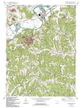
Gnadenhutten Topo Map Ohio
To zoom in, hover over the map of Gnadenhutten
USGS Topo Quad 40081c4 - 1:24,000 scale
| Topo Map Name: | Gnadenhutten |
| USGS Topo Quad ID: | 40081c4 |
| Print Size: | ca. 21 1/4" wide x 27" high |
| Southeast Coordinates: | 40.25° N latitude / 81.375° W longitude |
| Map Center Coordinates: | 40.3125° N latitude / 81.4375° W longitude |
| U.S. State: | OH |
| Filename: | o40081c4.jpg |
| Download Map JPG Image: | Gnadenhutten topo map 1:24,000 scale |
| Map Type: | Topographic |
| Topo Series: | 7.5´ |
| Map Scale: | 1:24,000 |
| Source of Map Images: | United States Geological Survey (USGS) |
| Alternate Map Versions: |
Gnadenhutten OH 1962, updated 1963 Download PDF Buy paper map Gnadenhutten OH 1962, updated 1963 Download PDF Buy paper map Gnadenhutten OH 1962, updated 1978 Download PDF Buy paper map Gnadenhutten OH 1962, updated 1985 Download PDF Buy paper map Gnadenhutten OH 1993, updated 1993 Download PDF Buy paper map Gnadenhutten OH 1994, updated 1998 Download PDF Buy paper map Gnadenhutten OH 2010 Download PDF Buy paper map Gnadenhutten OH 2013 Download PDF Buy paper map Gnadenhutten OH 2016 Download PDF Buy paper map |
1:24,000 Topo Quads surrounding Gnadenhutten
> Back to 40081a1 at 1:100,000 scale
> Back to 40080a1 at 1:250,000 scale
> Back to U.S. Topo Maps home
Gnadenhutten topo map: Gazetteer
Gnadenhutten: Airports
Fillmans Farms Field elevation 249m 816′Gnadenhutten: Dams
Lake Greenbriar Dam elevation 272m 892′Gnadenhutten: Lakes
Lake Page elevation 301m 987′Gnadenhutten: Parks
Gnadenhutten Historical Park elevation 256m 839′Hecks Grove Park elevation 256m 839′
Gnadenhutten: Populated Places
Elm (historical) elevation 271m 889′Gilmore elevation 364m 1194′
Gnadenhutten elevation 255m 836′
Hartwood elevation 332m 1089′
Lock Seventeen elevation 251m 823′
Yankeetown (historical) elevation 253m 830′
Gnadenhutten: Post Offices
Gilmore Post Office (historical) elevation 371m 1217′Gnadenhutten Post Office elevation 257m 843′
Hartwood Post Office (historical) elevation 318m 1043′
North Springfield Post Office (historical) elevation 250m 820′
Gnadenhutten: Reservoirs
Lake Greenbriar elevation 272m 892′Gnadenhutten: Streams
Frys Creek elevation 246m 807′Johnson Run elevation 251m 823′
Gnadenhutten: Valleys
Fox Valley elevation 255m 836′Frys Valley elevation 254m 833′
Murphy Hollow elevation 257m 843′
Gnadenhutten digital topo map on disk
Buy this Gnadenhutten topo map showing relief, roads, GPS coordinates and other geographical features, as a high-resolution digital map file on DVD:


