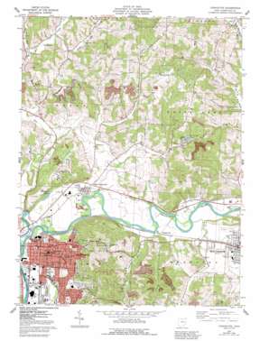
Coshocton Topo Map Ohio
To zoom in, hover over the map of Coshocton
USGS Topo Quad 40081c7 - 1:24,000 scale
| Topo Map Name: | Coshocton |
| USGS Topo Quad ID: | 40081c7 |
| Print Size: | ca. 21 1/4" wide x 27" high |
| Southeast Coordinates: | 40.25° N latitude / 81.75° W longitude |
| Map Center Coordinates: | 40.3125° N latitude / 81.8125° W longitude |
| U.S. State: | OH |
| Filename: | o40081c7.jpg |
| Download Map JPG Image: | Coshocton topo map 1:24,000 scale |
| Map Type: | Topographic |
| Topo Series: | 7.5´ |
| Map Scale: | 1:24,000 |
| Source of Map Images: | United States Geological Survey (USGS) |
| Alternate Map Versions: |
Coshocton OH 1961, updated 1963 Download PDF Buy paper map Coshocton OH 1961, updated 1978 Download PDF Buy paper map Coshocton OH 1961, updated 1985 Download PDF Buy paper map Coshocton OH 1961, updated 1992 Download PDF Buy paper map Coshocton OH 1994, updated 1998 Download PDF Buy paper map Coshocton OH 2010 Download PDF Buy paper map Coshocton OH 2013 Download PDF Buy paper map Coshocton OH 2016 Download PDF Buy paper map |
1:24,000 Topo Quads surrounding Coshocton
> Back to 40081a1 at 1:100,000 scale
> Back to 40080a1 at 1:250,000 scale
> Back to U.S. Topo Maps home
Coshocton topo map: Gazetteer
Coshocton: Airports
Richard Downing Airport elevation 296m 971′Coshocton: Areas
North Appalachian Experimental Watershed elevation 305m 1000′Coshocton: Lakes
Mudport Basin elevation 233m 764′Coshocton: Parks
Lake Park elevation 228m 748′Stewart Field elevation 230m 754′
Coshocton: Populated Places
Canal Lewisville elevation 234m 767′Chili elevation 244m 800′
Coshocton elevation 235m 770′
Hardscrabble elevation 319m 1046′
Keene elevation 312m 1023′
Morgan Run elevation 231m 757′
Munsville (historical) elevation 301m 987′
West Lafayette elevation 245m 803′
Coshocton: Post Offices
Canal Lewisville Post Office (historical) elevation 233m 764′Chili Post Office (historical) elevation 243m 797′
Coshocton Post Office elevation 235m 770′
Keene Post Office elevation 312m 1023′
Munnsville Post Office (historical) elevation 309m 1013′
West Lafayette Post Office elevation 245m 803′
Coshocton: Reservoirs
Forest Hill Lake elevation 271m 889′Middle Basin elevation 232m 761′
Coshocton: Streams
Frocks Run elevation 240m 787′Little Mill Creek elevation 241m 790′
Morgan Run elevation 228m 748′
Spoon Creek elevation 231m 757′
Turkey Run elevation 238m 780′
Tuscarawas River elevation 224m 734′
Walhonding River elevation 224m 734′
Coshocton: Summits
Hardscrabble Hill elevation 346m 1135′Coshocton digital topo map on disk
Buy this Coshocton topo map showing relief, roads, GPS coordinates and other geographical features, as a high-resolution digital map file on DVD:


