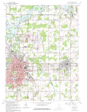
Alliance Topo Map Ohio
To zoom in, hover over the map of Alliance
USGS Topo Quad 40081h1 - 1:24,000 scale
| Topo Map Name: | Alliance |
| USGS Topo Quad ID: | 40081h1 |
| Print Size: | ca. 21 1/4" wide x 27" high |
| Southeast Coordinates: | 40.875° N latitude / 81° W longitude |
| Map Center Coordinates: | 40.9375° N latitude / 81.0625° W longitude |
| U.S. State: | OH |
| Filename: | o40081h1.jpg |
| Download Map JPG Image: | Alliance topo map 1:24,000 scale |
| Map Type: | Topographic |
| Topo Series: | 7.5´ |
| Map Scale: | 1:24,000 |
| Source of Map Images: | United States Geological Survey (USGS) |
| Alternate Map Versions: |
Alliance OH 1952, updated 1954 Download PDF Buy paper map Alliance OH 1952, updated 1965 Download PDF Buy paper map Alliance OH 1966, updated 1968 Download PDF Buy paper map Alliance OH 1966, updated 1972 Download PDF Buy paper map Alliance OH 1966, updated 1978 Download PDF Buy paper map Alliance OH 1994, updated 1997 Download PDF Buy paper map Alliance OH 2010 Download PDF Buy paper map Alliance OH 2013 Download PDF Buy paper map Alliance OH 2016 Download PDF Buy paper map |
1:24,000 Topo Quads surrounding Alliance
> Back to 40081e1 at 1:100,000 scale
> Back to 40080a1 at 1:250,000 scale
> Back to U.S. Topo Maps home
Alliance topo map: Gazetteer
Alliance: Airports
Alliance Airport elevation 325m 1066′Barber Airport elevation 321m 1053′
Berlin Airpark elevation 323m 1059′
Miller Field elevation 323m 1059′
Alliance: Canals
Oyster Ditch elevation 321m 1053′Alliance: Dams
Deer Creek Reservoir Dam elevation 313m 1026′Lake Park Dam elevation 322m 1056′
Westville Reservoir Dam elevation 336m 1102′
Alliance: Lakes
Lake Park elevation 322m 1056′Alliance: Parks
Alliance Public Square elevation 339m 1112′Deer Creek Park elevation 316m 1036′
Early Hill Park elevation 314m 1030′
Freedom Square elevation 339m 1112′
Maple Beach Park elevation 318m 1043′
Mount Union College Historic District elevation 373m 1223′
Rockhill Park elevation 330m 1082′
Silver Park elevation 372m 1220′
Thompson-Snodgrass Park elevation 342m 1122′
Alliance: Populated Places
Alden Park elevation 327m 1072′Alliance elevation 353m 1158′
Alliance Junction elevation 334m 1095′
Bolton elevation 321m 1053′
Country Squire Mobile Home Park elevation 327m 1072′
East Alliance elevation 322m 1056′
Hillcrest elevation 384m 1259′
Lexington elevation 320m 1049′
Maple Rest Mobile Court elevation 320m 1049′
Maple Ridge elevation 336m 1102′
McGarry (historical) elevation 348m 1141′
Mount Union elevation 374m 1227′
New Guinea (historical) elevation 319m 1046′
North Benton elevation 324m 1062′
North Benton Station elevation 319m 1046′
Sebring elevation 335m 1099′
Tecumseh Village Mobile Home Park elevation 353m 1158′
Williamsport elevation 319m 1046′
Alliance: Post Offices
Alliance Post Office elevation 338m 1108′Alliance Post Office elevation 352m 1154′
Mount Union Post Office (historical) elevation 374m 1227′
North Benton Post Office elevation 324m 1062′
Sebring Post Office elevation 335m 1099′
Alliance: Reservoirs
Deer Creek Reservoir elevation 313m 1026′Westville Lake elevation 336m 1102′
Alliance: Streams
Beech Creek elevation 312m 1023′Fish Creek elevation 317m 1040′
Island Creek elevation 313m 1026′
Alliance: Swamps
Bear Swamp (historical) elevation 318m 1043′Alliance digital topo map on disk
Buy this Alliance topo map showing relief, roads, GPS coordinates and other geographical features, as a high-resolution digital map file on DVD:


