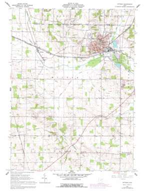
Rittman Topo Map Ohio
To zoom in, hover over the map of Rittman
USGS Topo Quad 40081h7 - 1:24,000 scale
| Topo Map Name: | Rittman |
| USGS Topo Quad ID: | 40081h7 |
| Print Size: | ca. 21 1/4" wide x 27" high |
| Southeast Coordinates: | 40.875° N latitude / 81.75° W longitude |
| Map Center Coordinates: | 40.9375° N latitude / 81.8125° W longitude |
| U.S. State: | OH |
| Filename: | o40081h7.jpg |
| Download Map JPG Image: | Rittman topo map 1:24,000 scale |
| Map Type: | Topographic |
| Topo Series: | 7.5´ |
| Map Scale: | 1:24,000 |
| Source of Map Images: | United States Geological Survey (USGS) |
| Alternate Map Versions: |
Rittman OH 1961, updated 1962 Download PDF Buy paper map Rittman OH 1961, updated 1974 Download PDF Buy paper map Rittman OH 1961, updated 1978 Download PDF Buy paper map Rittman OH 1994, updated 1997 Download PDF Buy paper map Rittman OH 2010 Download PDF Buy paper map Rittman OH 2013 Download PDF Buy paper map Rittman OH 2016 Download PDF Buy paper map |
1:24,000 Topo Quads surrounding Rittman
> Back to 40081e1 at 1:100,000 scale
> Back to 40080a1 at 1:250,000 scale
> Back to U.S. Topo Maps home
Rittman topo map: Gazetteer
Rittman: Canals
Steele Ditch elevation 295m 967′Whitman Ditch elevation 292m 958′
Rittman: Dams
Chippewa Conservation District Structure VII C Dam elevation 301m 987′Rawiga Country Club Lake Dam elevation 313m 1026′
Zuber Pond Dam elevation 315m 1033′
Rittman: Populated Places
Douglas (historical) elevation 324m 1062′Johnsons Corners elevation 295m 967′
Rittman elevation 299m 980′
Sterling elevation 294m 964′
Rittman: Post Offices
Amwell Post Office (historical) elevation 295m 967′Rittman: Reservoirs
Chippewa Creek Watershed 4a Reservoir elevation 323m 1059′Chippewa Watershed Conservation District Structure Reservoir elevation 301m 987′
Rawiga Country Club Lake elevation 313m 1026′
Zuber Pond elevation 315m 1033′
Rittman: Streams
Little Chippewa Creek elevation 289m 948′Styx River elevation 289m 948′
Tommy Run elevation 291m 954′
Rittman digital topo map on disk
Buy this Rittman topo map showing relief, roads, GPS coordinates and other geographical features, as a high-resolution digital map file on DVD:


