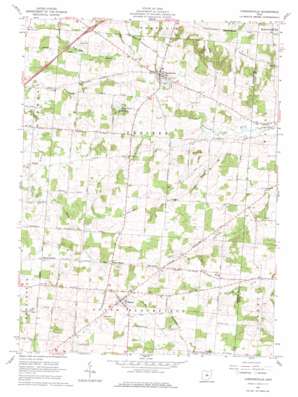
Chesterville Topo Map Ohio
To zoom in, hover over the map of Chesterville
USGS Topo Quad 40082d6 - 1:24,000 scale
| Topo Map Name: | Chesterville |
| USGS Topo Quad ID: | 40082d6 |
| Print Size: | ca. 21 1/4" wide x 27" high |
| Southeast Coordinates: | 40.375° N latitude / 82.625° W longitude |
| Map Center Coordinates: | 40.4375° N latitude / 82.6875° W longitude |
| U.S. State: | OH |
| Filename: | o40082d6.jpg |
| Download Map JPG Image: | Chesterville topo map 1:24,000 scale |
| Map Type: | Topographic |
| Topo Series: | 7.5´ |
| Map Scale: | 1:24,000 |
| Source of Map Images: | United States Geological Survey (USGS) |
| Alternate Map Versions: |
Chesterville OH 1961, updated 1962 Download PDF Buy paper map Chesterville OH 1961, updated 1977 Download PDF Buy paper map Chesterville OH 2010 Download PDF Buy paper map Chesterville OH 2013 Download PDF Buy paper map Chesterville OH 2016 Download PDF Buy paper map |
1:24,000 Topo Quads surrounding Chesterville
> Back to 40082a1 at 1:100,000 scale
> Back to 40082a1 at 1:250,000 scale
> Back to U.S. Topo Maps home
Chesterville topo map: Gazetteer
Chesterville: Crossings
Interchange 151 elevation 359m 1177′Chesterville: Dams
Anthony Mining Company Dam elevation 341m 1118′Lake Peniel Dam elevation 355m 1164′
Chesterville: Lakes
Rogers Lake elevation 349m 1145′Chesterville: Populated Places
Aaronsburg (historical) elevation 408m 1338′Chesterville elevation 349m 1145′
Lucerne elevation 332m 1089′
Sparta elevation 414m 1358′
Chesterville: Post Offices
Chesterville Post Office elevation 353m 1158′Lucerne Post Office (historical) elevation 332m 1089′
Sparta Post Office elevation 414m 1358′
Chesterville: Reservoirs
Anthony Mining Company Pond elevation 341m 1118′Lake Peniel elevation 355m 1164′
Chesterville: Streams
South Branch Kokosing River elevation 338m 1108′Sylvester Run elevation 343m 1125′
Chesterville: Summits
Hulse Hill elevation 433m 1420′Chesterville digital topo map on disk
Buy this Chesterville topo map showing relief, roads, GPS coordinates and other geographical features, as a high-resolution digital map file on DVD:


