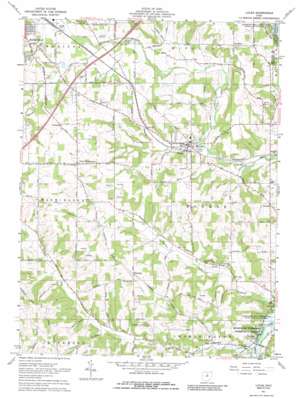
Lucas Topo Map Ohio
To zoom in, hover over the map of Lucas
USGS Topo Quad 40082f4 - 1:24,000 scale
| Topo Map Name: | Lucas |
| USGS Topo Quad ID: | 40082f4 |
| Print Size: | ca. 21 1/4" wide x 27" high |
| Southeast Coordinates: | 40.625° N latitude / 82.375° W longitude |
| Map Center Coordinates: | 40.6875° N latitude / 82.4375° W longitude |
| U.S. State: | OH |
| Filename: | o40082f4.jpg |
| Download Map JPG Image: | Lucas topo map 1:24,000 scale |
| Map Type: | Topographic |
| Topo Series: | 7.5´ |
| Map Scale: | 1:24,000 |
| Source of Map Images: | United States Geological Survey (USGS) |
| Alternate Map Versions: |
Lucas OH 1961, updated 1963 Download PDF Buy paper map Lucas OH 1961, updated 1972 Download PDF Buy paper map Lucas OH 1961, updated 1986 Download PDF Buy paper map Lucas OH 2010 Download PDF Buy paper map Lucas OH 2013 Download PDF Buy paper map Lucas OH 2016 Download PDF Buy paper map |
1:24,000 Topo Quads surrounding Lucas
> Back to 40082e1 at 1:100,000 scale
> Back to 40082a1 at 1:250,000 scale
> Back to U.S. Topo Maps home
Lucas topo map: Gazetteer
Lucas: Dams
Geottl Pond Dam elevation 342m 1122′Lucas: Parks
Malabar Farm State Park elevation 351m 1151′Lucas: Populated Places
Cesarea elevation 425m 1394′Crimson elevation 372m 1220′
Culler Mill elevation 313m 1026′
Greenfield Estates Mobile Home Park elevation 351m 1151′
Hastings elevation 399m 1309′
Little Washington elevation 419m 1374′
Lucas elevation 333m 1092′
Newville elevation 319m 1046′
Pinhook elevation 388m 1272′
West Shore Cottage Area elevation 314m 1030′
Lucas: Post Offices
Crimson Post Office (historical) elevation 372m 1220′Hastings Post Office (historical) elevation 401m 1315′
Lucas Post Office elevation 333m 1092′
Lucas Post Office elevation 333m 1092′
Newville Post Office (historical) elevation 322m 1056′
Lucas: Reservoirs
Geottl Pond elevation 342m 1122′Lucas: Streams
Possum Run elevation 314m 1030′Lucas digital topo map on disk
Buy this Lucas topo map showing relief, roads, GPS coordinates and other geographical features, as a high-resolution digital map file on DVD:


