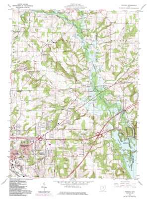
Pavonia Topo Map Ohio
To zoom in, hover over the map of Pavonia
USGS Topo Quad 40082g4 - 1:24,000 scale
| Topo Map Name: | Pavonia |
| USGS Topo Quad ID: | 40082g4 |
| Print Size: | ca. 21 1/4" wide x 27" high |
| Southeast Coordinates: | 40.75° N latitude / 82.375° W longitude |
| Map Center Coordinates: | 40.8125° N latitude / 82.4375° W longitude |
| U.S. State: | OH |
| Filename: | o40082g4.jpg |
| Download Map JPG Image: | Pavonia topo map 1:24,000 scale |
| Map Type: | Topographic |
| Topo Series: | 7.5´ |
| Map Scale: | 1:24,000 |
| Source of Map Images: | United States Geological Survey (USGS) |
| Alternate Map Versions: |
Pavonia OH 1960, updated 1962 Download PDF Buy paper map Pavonia OH 1960, updated 1973 Download PDF Buy paper map Pavonia OH 1960, updated 1984 Download PDF Buy paper map Pavonia OH 2010 Download PDF Buy paper map Pavonia OH 2013 Download PDF Buy paper map Pavonia OH 2016 Download PDF Buy paper map |
1:24,000 Topo Quads surrounding Pavonia
> Back to 40082e1 at 1:100,000 scale
> Back to 40082a1 at 1:250,000 scale
> Back to U.S. Topo Maps home
Pavonia topo map: Gazetteer
Pavonia: Airports
Gorman Air Airport elevation 378m 1240′Rall Field elevation 401m 1315′
Pavonia: Crossings
Interchange 176 elevation 332m 1089′Pavonia: Lakes
Sites Lake elevation 302m 990′Pavonia: Parks
Liberty Park elevation 392m 1286′Pavonia: Populated Places
Ashfield Estates Mobile Home Park elevation 369m 1210′Colonial Hills elevation 394m 1292′
East Mansfield elevation 353m 1158′
Epworth elevation 343m 1125′
Fairview Mobile Home Park elevation 375m 1230′
Five Points elevation 328m 1076′
Fleming Falls elevation 345m 1131′
Forest Hills Mobile Park elevation 390m 1279′
Hidden Valley Mobile Home Park elevation 406m 1332′
Hillside Mobile Home Park elevation 353m 1158′
Lincoln Heights elevation 399m 1309′
Madison City Mobile Home Park elevation 398m 1305′
Paradise Hill elevation 371m 1217′
Pavonia elevation 334m 1095′
Shady Lane Mobile Home Park elevation 409m 1341′
Sites Lake Cottage Area elevation 315m 1033′
Windsor elevation 314m 1030′
Wooster Heights elevation 405m 1328′
Pavonia: Post Offices
Epworth Post Office (historical) elevation 341m 1118′Paradise Hill Post Office (historical) elevation 370m 1213′
Pavonia Post Office (historical) elevation 331m 1085′
Pavonia: Streams
Friends Creek elevation 313m 1026′Whetstone Creek elevation 308m 1010′
Pavonia digital topo map on disk
Buy this Pavonia topo map showing relief, roads, GPS coordinates and other geographical features, as a high-resolution digital map file on DVD:


