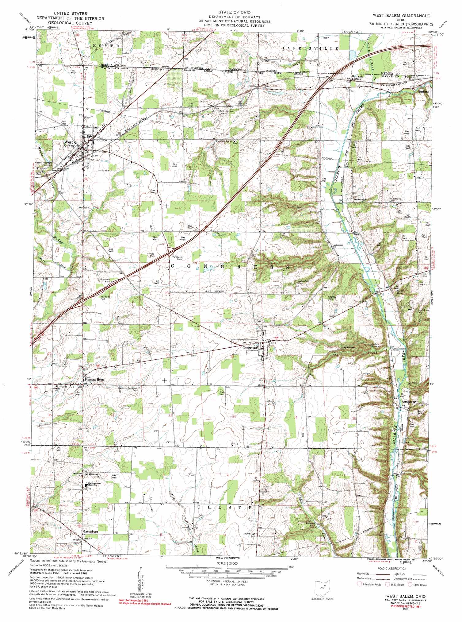
West Salem Topo Map Ohio
To zoom in, hover over the map of West Salem
USGS Topo Quad 40082h1 - 1:24,000 scale
| Topo Map Name: | West Salem |
| USGS Topo Quad ID: | 40082h1 |
| Print Size: | ca. 21 1/4" wide x 27" high |
| Southeast Coordinates: | 40.875° N latitude / 82° W longitude |
| Map Center Coordinates: | 40.9375° N latitude / 82.0625° W longitude |
| U.S. State: | OH |
| Filename: | o40082h1.jpg |
| Download Map JPG Image: | West Salem topo map 1:24,000 scale |
| Map Type: | Topographic |
| Topo Series: | 7.5´ |
| Map Scale: | 1:24,000 |
| Source of Map Images: | United States Geological Survey (USGS) |
| Alternate Map Versions: |
West Salem OH 1961, updated 1962 Download PDF Buy paper map West Salem OH 1961, updated 1991 Download PDF Buy paper map West Salem OH 2010 Download PDF Buy paper map West Salem OH 2013 Download PDF Buy paper map West Salem OH 2016 Download PDF Buy paper map |
1:24,000 Topo Quads surrounding West Salem
Brighton |
Wellington |
Lagrange |
Mallet Creek |
Medina |
Nova |
Sullivan |
Lodi |
Westfield Center |
Seville |
Ashland North |
Polk |
West Salem |
Creston |
Rittman |
Ashland South |
Jeromesville |
New Pittsburg |
Wooster |
Orrville |
Perrysville |
Loudonville |
Shreve |
Holmesville |
Fredericksburg |
> Back to 40082e1 at 1:100,000 scale
> Back to 40082a1 at 1:250,000 scale
> Back to U.S. Topo Maps home
West Salem topo map: Gazetteer
West Salem: Airports
Pleasant Home Gliding Club Gliderport elevation 321m 1053′West Salem: Crossings
Interchange 196 elevation 335m 1099′West Salem: Dams
Boreman Lake Dam elevation 341m 1118′West Salem: Populated Places
Armstrong elevation 277m 908′Aukerman elevation 282m 925′
Congress elevation 354m 1161′
Lattasburg elevation 353m 1158′
Lea Crest Estates Mobile Home Park elevation 329m 1079′
Pleasant Home elevation 323m 1059′
West Salem elevation 339m 1112′
West Salem: Reservoirs
Boreman Lake elevation 341m 1118′West Salem: Streams
Little Killbuck Creek elevation 275m 902′Repp Run elevation 277m 908′
Shade Creek elevation 273m 895′
Wolf Run elevation 311m 1020′
West Salem digital topo map on disk
Buy this West Salem topo map showing relief, roads, GPS coordinates and other geographical features, as a high-resolution digital map file on DVD:
 map DVD")