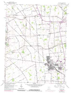
Hilliard Topo Map Ohio
To zoom in, hover over the map of Hilliard
USGS Topo Quad 40083a2 - 1:24,000 scale
| Topo Map Name: | Hilliard |
| USGS Topo Quad ID: | 40083a2 |
| Print Size: | ca. 21 1/4" wide x 27" high |
| Southeast Coordinates: | 40° N latitude / 83.125° W longitude |
| Map Center Coordinates: | 40.0625° N latitude / 83.1875° W longitude |
| U.S. State: | OH |
| Filename: | o40083a2.jpg |
| Download Map JPG Image: | Hilliard topo map 1:24,000 scale |
| Map Type: | Topographic |
| Topo Series: | 7.5´ |
| Map Scale: | 1:24,000 |
| Source of Map Images: | United States Geological Survey (USGS) |
| Alternate Map Versions: |
Hilliard OH 1954, updated 1956 Download PDF Buy paper map Hilliard OH 1966, updated 1968 Download PDF Buy paper map Hilliard OH 1966, updated 1974 Download PDF Buy paper map Hilliard OH 1966, updated 1974 Download PDF Buy paper map Hilliard OH 1966, updated 1984 Download PDF Buy paper map Hilliard OH 1966, updated 1989 Download PDF Buy paper map Hilliard OH 2010 Download PDF Buy paper map Hilliard OH 2013 Download PDF Buy paper map Hilliard OH 2016 Download PDF Buy paper map |
1:24,000 Topo Quads surrounding Hilliard
> Back to 40083a1 at 1:100,000 scale
> Back to 40082a1 at 1:250,000 scale
> Back to U.S. Topo Maps home
Hilliard topo map: Gazetteer
Hilliard: Airports
Miami Valley Heliport elevation 286m 938′Parknavy Stolport elevation 287m 941′
Red Roof Inns Heliport elevation 267m 875′
Ritters Airport elevation 283m 928′
Stouffers Dublin Heliport elevation 270m 885′
Hilliard: Canals
Ballenger Ditch elevation 282m 925′Burkett Ditch elevation 280m 918′
Cary Ditch elevation 285m 935′
Clover Groff Ditch elevation 285m 935′
Converse Ditch elevation 282m 925′
Cosgray Ditch elevation 274m 898′
Cramer Ditch elevation 276m 905′
George Geary Ditch elevation 274m 898′
Gordon Tri-County Ditch elevation 286m 938′
Kile Ditch elevation 286m 938′
Sherwood Ditch elevation 283m 928′
Tudor Ditch elevation 267m 875′
Worthington Sherwood Ditch elevation 282m 925′
Hilliard: Crossings
Interchange 17 elevation 270m 885′Hilliard: Parks
Avery Park elevation 280m 918′Coffman Park elevation 269m 882′
Hamilton Park elevation 281m 921′
Hilliard Municipal Park elevation 286m 938′
Hilliard: Populated Places
Amlin elevation 287m 941′Hayden elevation 289m 948′
Hilliard elevation 285m 935′
Kileville elevation 289m 948′
Lamb Corners elevation 287m 941′
Mudsock elevation 284m 931′
Sandy Corners elevation 281m 921′
Hilliard: Post Offices
Amlin Post Office elevation 287m 941′Hayden Post Office (historical) elevation 289m 948′
Hilliard Post Office elevation 285m 935′
Kileville Post Office (historical) elevation 289m 948′
Hilliard digital topo map on disk
Buy this Hilliard topo map showing relief, roads, GPS coordinates and other geographical features, as a high-resolution digital map file on DVD:


