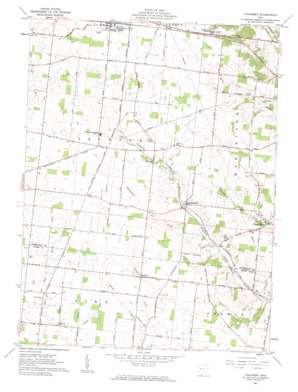
Thackery Topo Map Ohio
To zoom in, hover over the map of Thackery
USGS Topo Quad 40083a8 - 1:24,000 scale
| Topo Map Name: | Thackery |
| USGS Topo Quad ID: | 40083a8 |
| Print Size: | ca. 21 1/4" wide x 27" high |
| Southeast Coordinates: | 40° N latitude / 83.875° W longitude |
| Map Center Coordinates: | 40.0625° N latitude / 83.9375° W longitude |
| U.S. State: | OH |
| Filename: | o40083a8.jpg |
| Download Map JPG Image: | Thackery topo map 1:24,000 scale |
| Map Type: | Topographic |
| Topo Series: | 7.5´ |
| Map Scale: | 1:24,000 |
| Source of Map Images: | United States Geological Survey (USGS) |
| Alternate Map Versions: |
Thackery OH 1961, updated 1962 Download PDF Buy paper map Thackery OH 2010 Download PDF Buy paper map Thackery OH 2013 Download PDF Buy paper map Thackery OH 2016 Download PDF Buy paper map |
1:24,000 Topo Quads surrounding Thackery
> Back to 40083a1 at 1:100,000 scale
> Back to 40082a1 at 1:250,000 scale
> Back to U.S. Topo Maps home
Thackery topo map: Gazetteer
Thackery: Airports
Reeds Airport elevation 364m 1194′Thackery: Canals
Thackery Ditch elevation 342m 1122′Thackery: Populated Places
Bryar elevation 319m 1046′Darnell elevation 347m 1138′
Dialton elevation 349m 1145′
Proctor (historical) elevation 356m 1167′
Terre Haute elevation 329m 1079′
Thackery elevation 339m 1112′
Windy Corner elevation 355m 1164′
Thackery: Post Offices
Dialton Post Office (historical) elevation 351m 1151′Terre Haute Post Office (historical) elevation 331m 1085′
Thackery Post Office (historical) elevation 339m 1112′
Thackery: Streams
Blacksnake Creek elevation 332m 1089′Deer Creek elevation 326m 1069′
Kitty Creek elevation 326m 1069′
Thackery digital topo map on disk
Buy this Thackery topo map showing relief, roads, GPS coordinates and other geographical features, as a high-resolution digital map file on DVD:


