Marysville Topo Map Ohio
To zoom in, hover over the map of Marysville
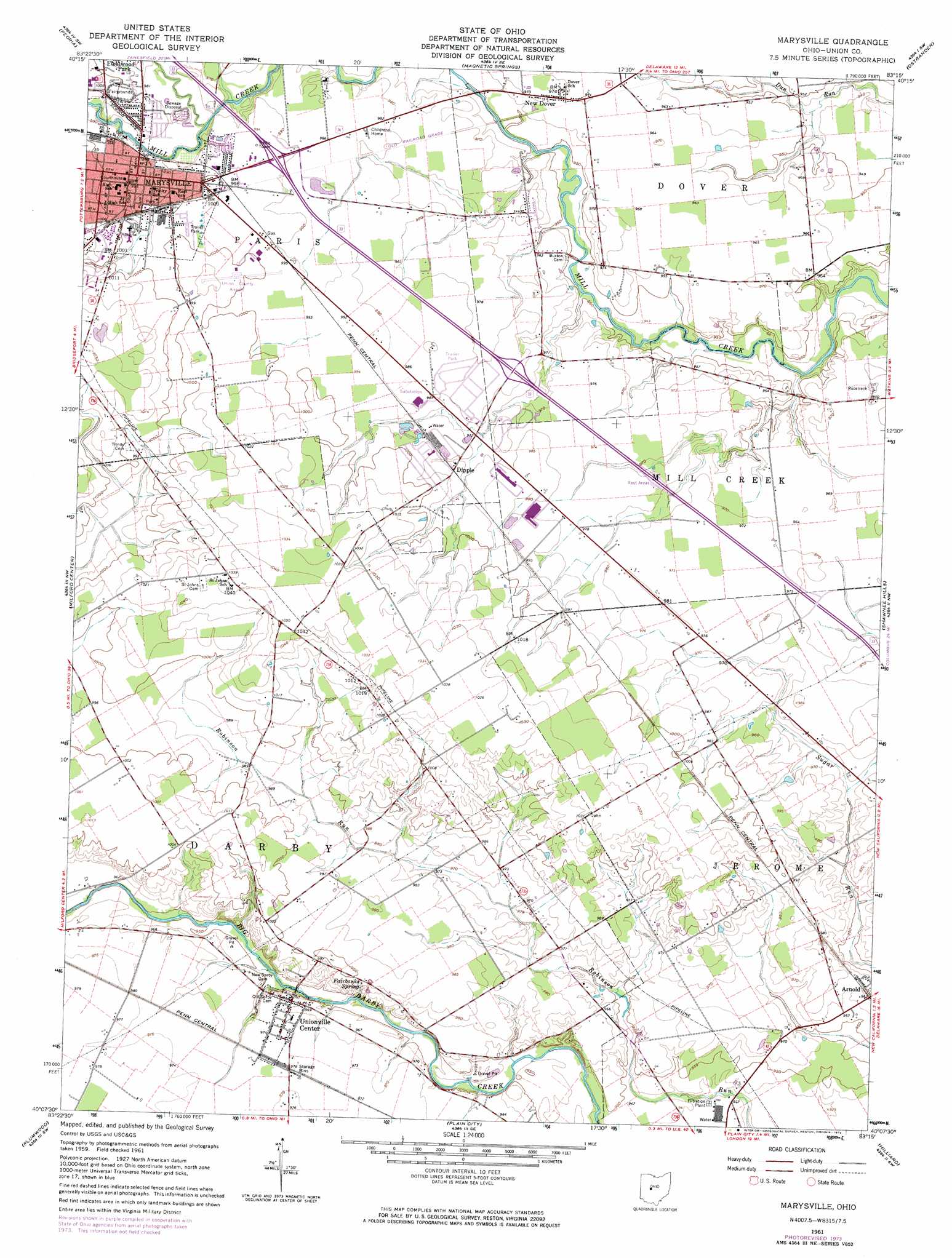
USGS Topo Quad 40083b3 - 1:24,000 scale
| Topo Map Name: | Marysville |
| USGS Topo Quad ID: | 40083b3 |
| Print Size: | ca. 21 1/4" wide x 27" high |
| Southeast Coordinates: | 40.125° N latitude / 83.25° W longitude |
| Map Center Coordinates: | 40.1875° N latitude / 83.3125° W longitude |
| U.S. State: | OH |
| Filename: | o40083b3.jpg |
| Download Map JPG Image: | Marysville topo map 1:24,000 scale |
| Map Type: | Topographic |
| Topo Series: | 7.5´ |
| Map Scale: | 1:24,000 |
| Source of Map Images: | United States Geological Survey (USGS) |
| Alternate Map Versions: |
Marysville OH 1961, updated 1962 Download PDF Buy paper map Marysville OH 1961, updated 1974 Download PDF Buy paper map Marysville OH 1961, updated 1974 Download PDF Buy paper map Marysville OH 2010 Download PDF Buy paper map Marysville OH 2013 Download PDF Buy paper map Marysville OH 2016 Download PDF Buy paper map |
1:24,000 Topo Quads surrounding Marysville
West Mansfield |
York Center |
Richwood |
Prospect |
Waldo |
East Liberty |
Peoria |
Magnetic Springs |
Ostrander |
Delaware |
North Lewisburg |
Milford Center |
Marysville |
Shawnee Hills |
Powell |
Mechanicsburg |
Plumwood |
Plain City |
Hilliard |
Northwest Columbus |
South Vienna |
London |
West Jefferson |
Galloway |
Southwest Columbus |
> Back to 40083a1 at 1:100,000 scale
> Back to 40082a1 at 1:250,000 scale
> Back to U.S. Topo Maps home
Marysville topo map: Gazetteer
Marysville: Airports
J-EM Farm Airport elevation 308m 1010′Union County Airport elevation 306m 1003′
Marysville: Parks
Airport Park elevation 303m 994′Cardinal Market Park elevation 304m 997′
Eljer Park elevation 302m 990′
Marysville Historic District elevation 303m 994′
McCarthy Park elevation 297m 974′
Schwartzkopf Park elevation 298m 977′
Marysville: Populated Places
Arnold elevation 292m 958′Countryside Mobile Home Park elevation 304m 997′
Dipple elevation 300m 984′
Hillcrest Mobile Home Park elevation 299m 980′
Marysville elevation 302m 990′
Marysville Estates elevation 298m 977′
Millcreek Meadows elevation 302m 990′
New Dover elevation 295m 967′
Pleasant Ridge elevation 296m 971′
Unionville Center elevation 296m 971′
Marysville: Post Offices
Arnold Post Office (historical) elevation 292m 958′Marysville Post Office elevation 301m 987′
Unionville Center Post Office elevation 296m 971′
Marysville: Springs
Fairbanks Spring elevation 295m 967′Marysville: Streams
Crosses Run elevation 295m 967′Tombstone Creek elevation 288m 944′
Marysville digital topo map on disk
Buy this Marysville topo map showing relief, roads, GPS coordinates and other geographical features, as a high-resolution digital map file on DVD:
 map DVD")