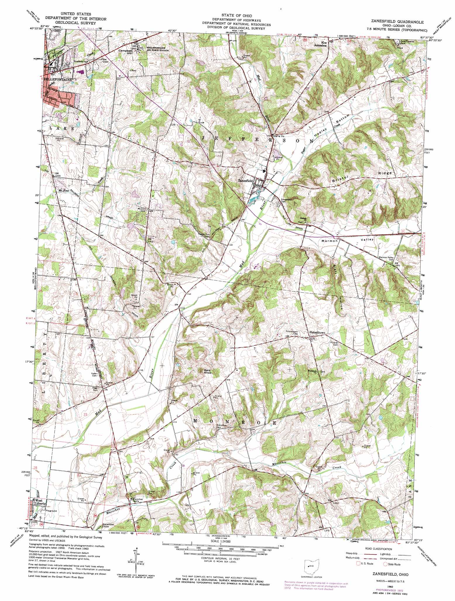
Zanesfield Topo Map Ohio
To zoom in, hover over the map of Zanesfield
USGS Topo Quad 40083c6 - 1:24,000 scale
| Topo Map Name: | Zanesfield |
| USGS Topo Quad ID: | 40083c6 |
| Print Size: | ca. 21 1/4" wide x 27" high |
| Southeast Coordinates: | 40.25° N latitude / 83.625° W longitude |
| Map Center Coordinates: | 40.3125° N latitude / 83.6875° W longitude |
| U.S. State: | OH |
| Filename: | o40083c6.jpg |
| Download Map JPG Image: | Zanesfield topo map 1:24,000 scale |
| Map Type: | Topographic |
| Topo Series: | 7.5´ |
| Map Scale: | 1:24,000 |
| Source of Map Images: | United States Geological Survey (USGS) |
| Alternate Map Versions: |
Zanesfield OH 1960, updated 1962 Download PDF Buy paper map Zanesfield OH 1960, updated 1962 Download PDF Buy paper map Zanesfield OH 1960, updated 1973 Download PDF Buy paper map Zanesfield OH 2010 Download PDF Buy paper map Zanesfield OH 2013 Download PDF Buy paper map Zanesfield OH 2016 Download PDF Buy paper map |
1:24,000 Topo Quads surrounding Zanesfield
Waynesfield |
Roundhead |
Silver Creek |
Mount Victory |
La Rue |
Russells Point |
Huntsville |
Rushsylvania |
West Mansfield |
York Center |
De Graff |
Bellefontaine |
Zanesfield |
East Liberty |
Peoria |
Saint Paris |
Northville |
Kingscreek |
North Lewisburg |
Milford Center |
Thackery |
Urbana West |
Urbana East |
Mechanicsburg |
Plumwood |
> Back to 40083a1 at 1:100,000 scale
> Back to 40082a1 at 1:250,000 scale
> Back to U.S. Topo Maps home
Zanesfield topo map: Gazetteer
Zanesfield: Dams
Drumm Pond Dam elevation 420m 1377′Zanesfield: Parks
Carter Park elevation 427m 1400′Jack Martin Park elevation 418m 1371′
Valley Hi Ski Area elevation 436m 1430′
Zane Caverns Park elevation 386m 1266′
Zanesfield: Populated Places
Macochee Castle elevation 341m 1118′New Jerusalem elevation 445m 1459′
Pickrelltown elevation 430m 1410′
Valley Hi elevation 387m 1269′
Zanesfield elevation 358m 1174′
Zanesfield: Post Offices
Mac-o-chee Post Office (historical) elevation 341m 1118′New Jerusalem Post Office (historical) elevation 448m 1469′
Pickrelltown Post Office (historical) elevation 429m 1407′
Zanesfield Post Office elevation 359m 1177′
Zanesfield: Reservoirs
Drumm Pond elevation 420m 1377′The Lower Lake elevation 406m 1332′
The Upper Lake elevation 414m 1358′
Zanesfield: Ridges
Bristol Ridge elevation 442m 1450′Zanesfield: Streams
Sugar Creek elevation 356m 1167′Zanesfield: Summits
Bald Knob elevation 434m 1423′Campbell Hill elevation 469m 1538′
Mount Miserable elevation 453m 1486′
Zanesfield: Valleys
Hadley Bottom elevation 362m 1187′Marmon Valley elevation 352m 1154′
Slaty Hollow elevation 371m 1217′
Zanesfield digital topo map on disk
Buy this Zanesfield topo map showing relief, roads, GPS coordinates and other geographical features, as a high-resolution digital map file on DVD:
 map DVD")