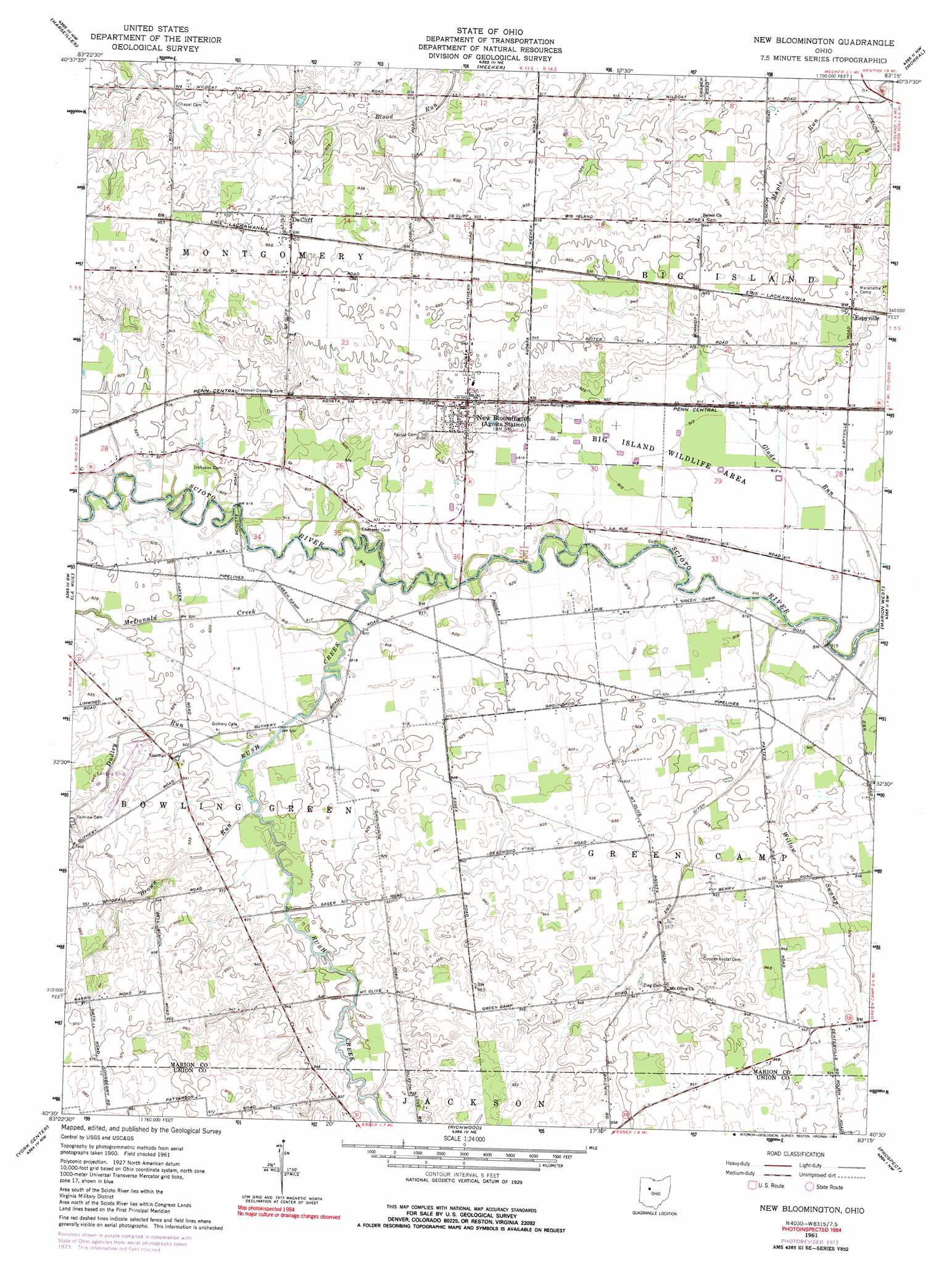
New Bloomington Topo Map Ohio
To zoom in, hover over the map of New Bloomington
USGS Topo Quad 40083e3 - 1:24,000 scale
| Topo Map Name: | New Bloomington |
| USGS Topo Quad ID: | 40083e3 |
| Print Size: | ca. 21 1/4" wide x 27" high |
| Southeast Coordinates: | 40.5° N latitude / 83.25° W longitude |
| Map Center Coordinates: | 40.5625° N latitude / 83.3125° W longitude |
| U.S. State: | OH |
| Filename: | o40083e3.jpg |
| Download Map JPG Image: | New Bloomington topo map 1:24,000 scale |
| Map Type: | Topographic |
| Topo Series: | 7.5´ |
| Map Scale: | 1:24,000 |
| Source of Map Images: | United States Geological Survey (USGS) |
| Alternate Map Versions: |
New Bloomington OH 1961, updated 1962 Download PDF Buy paper map New Bloomington OH 1961, updated 1975 Download PDF Buy paper map New Bloomington OH 1961, updated 1991 Download PDF Buy paper map New Bloomington OH 2010 Download PDF Buy paper map New Bloomington OH 2013 Download PDF Buy paper map New Bloomington OH 2016 Download PDF Buy paper map |
1:24,000 Topo Quads surrounding New Bloomington
Forest |
Wharton |
Upper Sandusky |
Nevada |
Oceola |
Kenton |
Marseilles |
Meeker |
Morral |
Monnett |
Mount Victory |
La Rue |
New Bloomington |
Marion West |
Marion East |
West Mansfield |
York Center |
Richwood |
Prospect |
Waldo |
East Liberty |
Peoria |
Magnetic Springs |
Ostrander |
Delaware |
> Back to 40083e1 at 1:100,000 scale
> Back to 40082a1 at 1:250,000 scale
> Back to U.S. Topo Maps home
New Bloomington topo map: Gazetteer
New Bloomington: Canals
Irey Ditch elevation 280m 918′Zieg Ditch elevation 281m 921′
New Bloomington: Dams
Big Island Wildlife Area Dam elevation 280m 918′New Bloomington: Parks
Big Island Wildlife Area elevation 278m 912′New Bloomington: Populated Places
DeCliff elevation 288m 944′Espyville elevation 288m 944′
Gurley (historical) elevation 280m 918′
Holmesville (historical) elevation 282m 925′
New Bloomington elevation 287m 941′
New Bloomington: Post Offices
Espyville Post Office (historical) elevation 288m 944′Gurley Post Office (historical) elevation 280m 918′
New Bloomington Post Office elevation 287m 941′
New Bloomington: Reservoirs
Big Island Wildlife Area Reservoir elevation 280m 918′New Bloomington: Streams
Brown Run elevation 279m 915′Dudley Run elevation 279m 915′
Glade Run elevation 274m 898′
McDonald Creek elevation 279m 915′
Rush Creek elevation 277m 908′
New Bloomington digital topo map on disk
Buy this New Bloomington topo map showing relief, roads, GPS coordinates and other geographical features, as a high-resolution digital map file on DVD:
 map DVD")