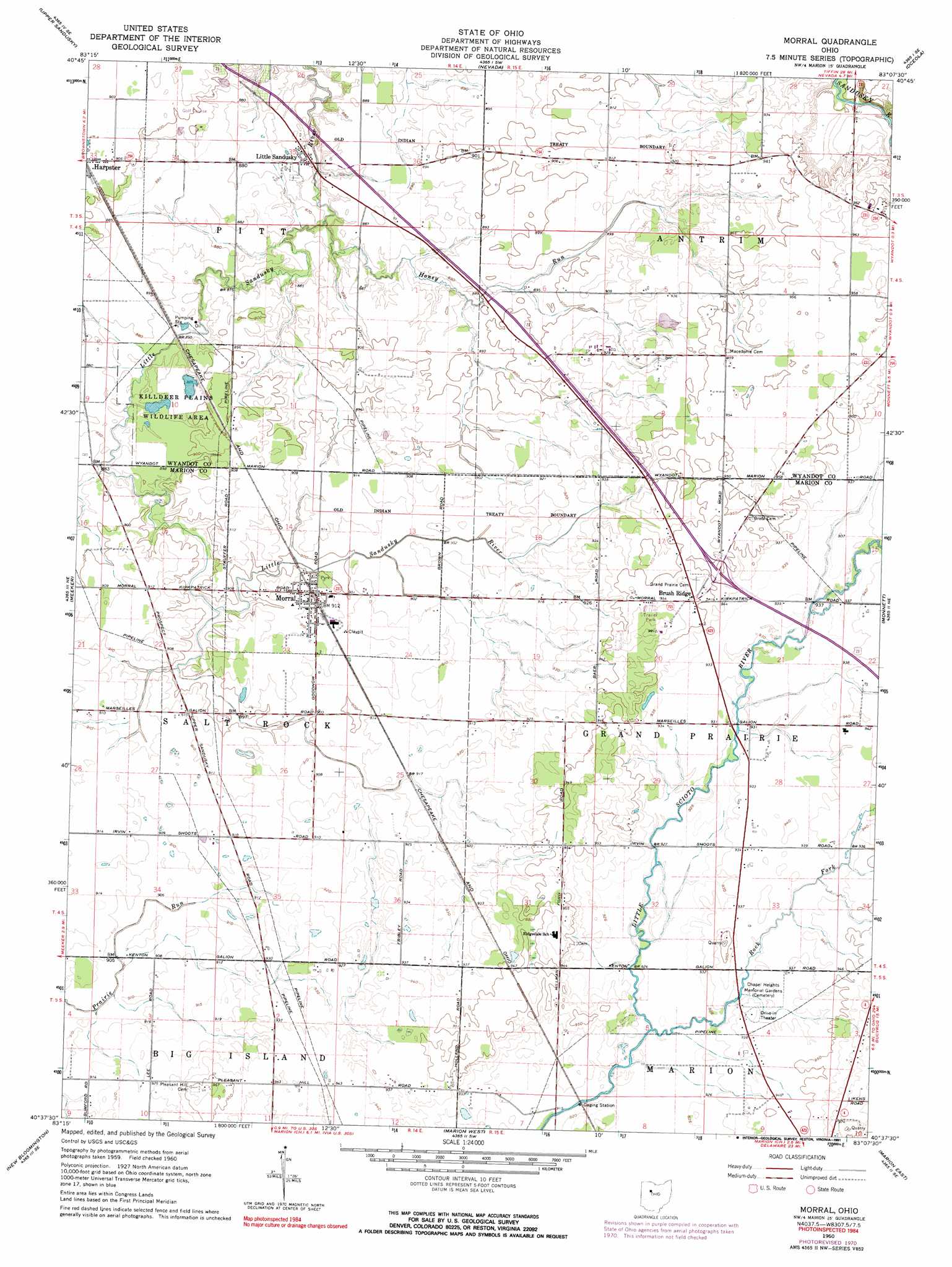
Morral Topo Map Ohio
To zoom in, hover over the map of Morral
USGS Topo Quad 40083f2 - 1:24,000 scale
| Topo Map Name: | Morral |
| USGS Topo Quad ID: | 40083f2 |
| Print Size: | ca. 21 1/4" wide x 27" high |
| Southeast Coordinates: | 40.625° N latitude / 83.125° W longitude |
| Map Center Coordinates: | 40.6875° N latitude / 83.1875° W longitude |
| U.S. State: | OH |
| Filename: | o40083f2.jpg |
| Download Map JPG Image: | Morral topo map 1:24,000 scale |
| Map Type: | Topographic |
| Topo Series: | 7.5´ |
| Map Scale: | 1:24,000 |
| Source of Map Images: | United States Geological Survey (USGS) |
| Alternate Map Versions: |
Morral OH 1960, updated 1962 Download PDF Buy paper map Morral OH 1960, updated 1972 Download PDF Buy paper map Morral OH 1960, updated 1991 Download PDF Buy paper map Morral OH 2010 Download PDF Buy paper map Morral OH 2013 Download PDF Buy paper map Morral OH 2016 Download PDF Buy paper map |
1:24,000 Topo Quads surrounding Morral
Carey |
Mccutchenville |
Sycamore |
Lykens |
Chatfield |
Wharton |
Upper Sandusky |
Nevada |
Oceola |
Bucyrus |
Marseilles |
Meeker |
Morral |
Monnett |
Caledonia |
La Rue |
New Bloomington |
Marion West |
Marion East |
Denmark |
York Center |
Richwood |
Prospect |
Waldo |
Ashley |
> Back to 40083e1 at 1:100,000 scale
> Back to 40082a1 at 1:250,000 scale
> Back to U.S. Topo Maps home
Morral topo map: Gazetteer
Morral: Dams
Edwin Naus Lake Dam elevation 284m 931′Morral: Populated Places
Brush Ridge elevation 290m 951′Carpenters Corners elevation 277m 908′
Little Sandusky elevation 266m 872′
Morral elevation 277m 908′
Morral: Post Offices
Morral Post Office elevation 277m 908′Morral: Reservoirs
Edwin Naus Lake elevation 284m 931′Morral: Streams
Honey Run elevation 262m 859′Morral Run elevation 271m 889′
Rock Fork elevation 280m 918′
Morral digital topo map on disk
Buy this Morral topo map showing relief, roads, GPS coordinates and other geographical features, as a high-resolution digital map file on DVD:
 map DVD")