Alger Topo Map Ohio
To zoom in, hover over the map of Alger
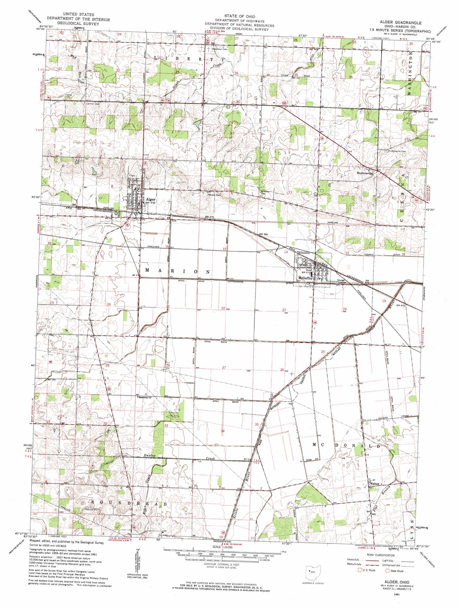
USGS Topo Quad 40083f7 - 1:24,000 scale
| Topo Map Name: | Alger |
| USGS Topo Quad ID: | 40083f7 |
| Print Size: | ca. 21 1/4" wide x 27" high |
| Southeast Coordinates: | 40.625° N latitude / 83.75° W longitude |
| Map Center Coordinates: | 40.6875° N latitude / 83.8125° W longitude |
| U.S. State: | OH |
| Filename: | o40083f7.jpg |
| Download Map JPG Image: | Alger topo map 1:24,000 scale |
| Map Type: | Topographic |
| Topo Series: | 7.5´ |
| Map Scale: | 1:24,000 |
| Source of Map Images: | United States Geological Survey (USGS) |
| Alternate Map Versions: |
Alger OH 1961, updated 1962 Download PDF Buy paper map Alger OH 2010 Download PDF Buy paper map Alger OH 2013 Download PDF Buy paper map Alger OH 2016 Download PDF Buy paper map |
1:24,000 Topo Quads surrounding Alger
Columbus Grove |
Bluffton |
Rawson |
Arlington |
Mount Blanchard |
Cairo |
Beaverdam |
Ada |
Dunkirk |
Forest |
Lima |
Harrod |
Alger |
Foraker |
Kenton |
Uniopolis |
Waynesfield |
Roundhead |
Silver Creek |
Mount Victory |
Jackson Center |
Russells Point |
Huntsville |
Rushsylvania |
West Mansfield |
> Back to 40083e1 at 1:100,000 scale
> Back to 40082a1 at 1:250,000 scale
> Back to U.S. Topo Maps home
Alger topo map: Gazetteer
Alger: Canals
Cooney Ditch elevation 294m 964′Cottonwood Ditch elevation 293m 961′
Alger: Populated Places
Alger elevation 298m 977′Huntersville elevation 300m 984′
McGuffey elevation 296m 971′
Quickstep elevation 300m 984′
Walton elevation 300m 984′
Alger: Post Offices
Alger Post Office elevation 298m 977′Huntersville Post Office (historical) elevation 299m 980′
McGuffey Post Office elevation 296m 971′
Alger: Streams
Dunlap Creek elevation 293m 961′Elder Creek elevation 295m 967′
Flat Branch elevation 291m 954′
Twin Branches elevation 293m 961′
Alger: Swamps
Scioto Marsh (historical) elevation 292m 958′Alger digital topo map on disk
Buy this Alger topo map showing relief, roads, GPS coordinates and other geographical features, as a high-resolution digital map file on DVD:
 map DVD")