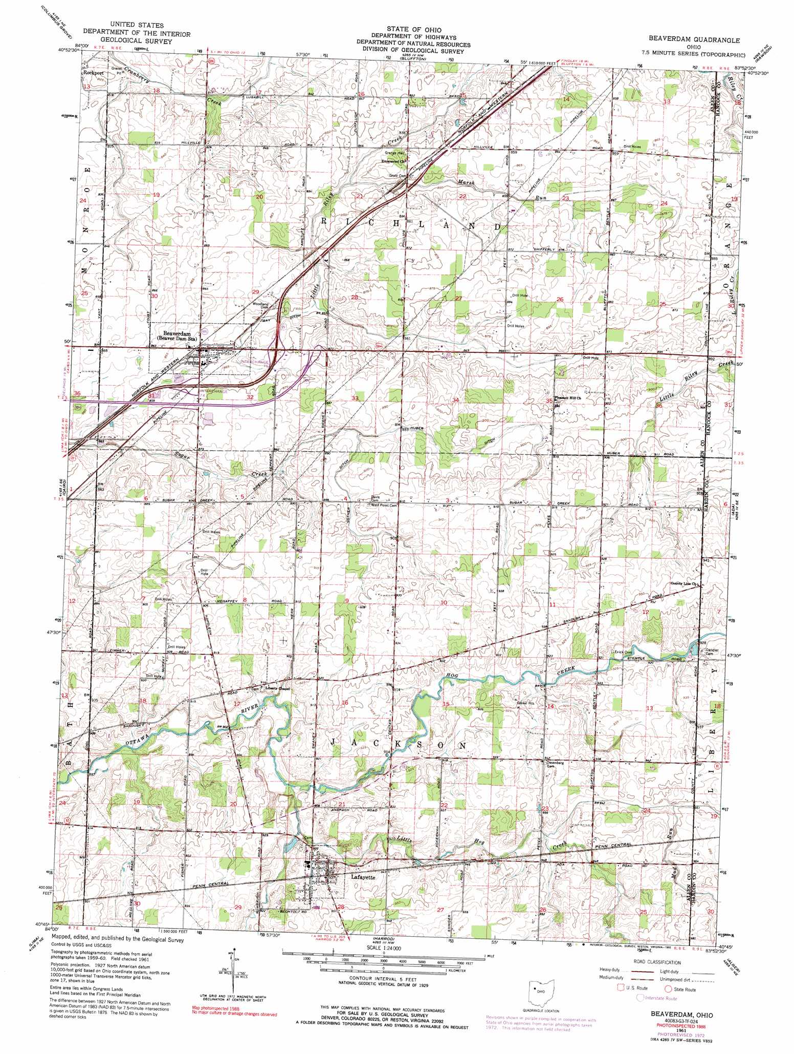
Beaverdam Topo Map Ohio
To zoom in, hover over the map of Beaverdam
USGS Topo Quad 40083g8 - 1:24,000 scale
| Topo Map Name: | Beaverdam |
| USGS Topo Quad ID: | 40083g8 |
| Print Size: | ca. 21 1/4" wide x 27" high |
| Southeast Coordinates: | 40.75° N latitude / 83.875° W longitude |
| Map Center Coordinates: | 40.8125° N latitude / 83.9375° W longitude |
| U.S. State: | OH |
| Filename: | o40083g8.jpg |
| Download Map JPG Image: | Beaverdam topo map 1:24,000 scale |
| Map Type: | Topographic |
| Topo Series: | 7.5´ |
| Map Scale: | 1:24,000 |
| Source of Map Images: | United States Geological Survey (USGS) |
| Alternate Map Versions: |
Beaverdam OH 1961, updated 1963 Download PDF Buy paper map Beaverdam OH 1961, updated 1973 Download PDF Buy paper map Beaverdam OH 1961, updated 1992 Download PDF Buy paper map Beaverdam OH 2010 Download PDF Buy paper map Beaverdam OH 2013 Download PDF Buy paper map Beaverdam OH 2016 Download PDF Buy paper map |
1:24,000 Topo Quads surrounding Beaverdam
Miller City |
Ottawa |
Leipsic |
Mccomb |
Findlay |
Kalida |
Columbus Grove |
Bluffton |
Rawson |
Arlington |
Elida |
Cairo |
Beaverdam |
Ada |
Dunkirk |
Cridersville |
Lima |
Harrod |
Alger |
Foraker |
Wapakoneta |
Uniopolis |
Waynesfield |
Roundhead |
Silver Creek |
> Back to 40083e1 at 1:100,000 scale
> Back to 40082a1 at 1:250,000 scale
> Back to U.S. Topo Maps home
Beaverdam topo map: Gazetteer
Beaverdam: Canals
Cotner Ditch elevation 271m 889′Huber Ditch elevation 269m 882′
May Ditch elevation 259m 849′
Beaverdam: Crossings
Interchange 134 elevation 265m 869′Interchange 135 elevation 266m 872′
Beaverdam: Populated Places
Beaver Dam Station elevation 261m 856′Beaverdam elevation 261m 856′
Lafayette elevation 283m 928′
Beaverdam: Post Offices
Beaverdam Post Office elevation 263m 862′LaFayette Post Office elevation 279m 915′
Beaverdam: Streams
Hog Creek elevation 273m 895′Little Hog Creek elevation 273m 895′
Marsh Run elevation 254m 833′
Mud Run elevation 284m 931′
Beaverdam digital topo map on disk
Buy this Beaverdam topo map showing relief, roads, GPS coordinates and other geographical features, as a high-resolution digital map file on DVD:
 map DVD")